Home /
Castromil Mines /
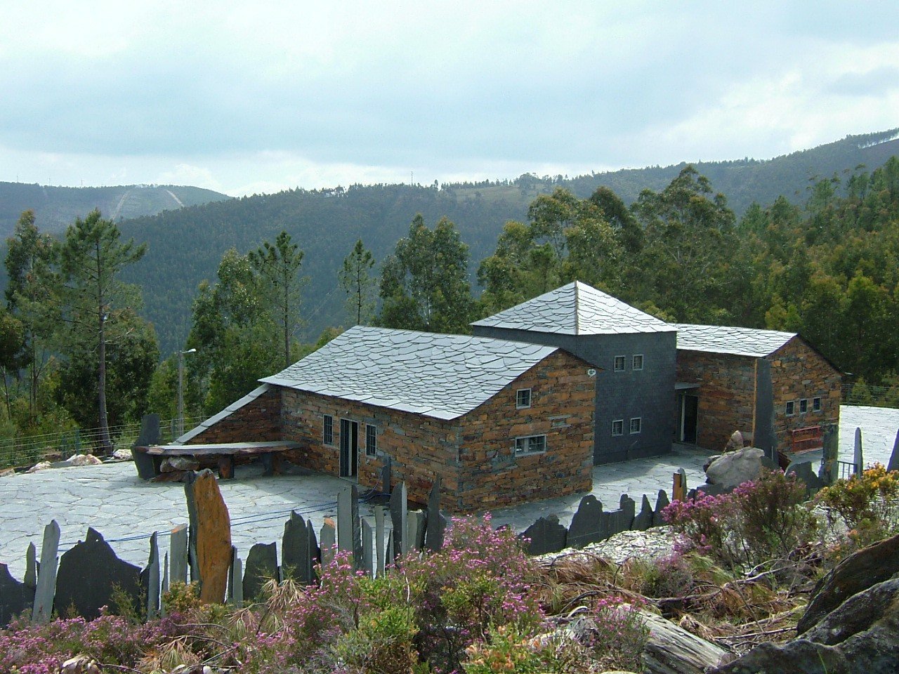
Castromil Gold Mines, Castromil
Castromil Gold Mines, Castromil
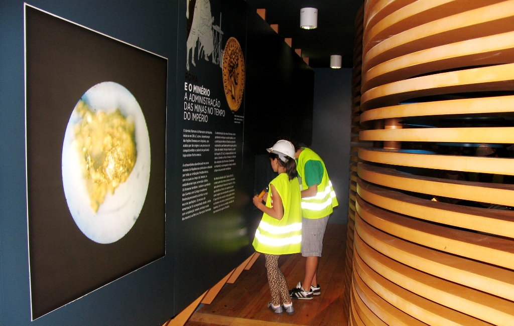
The municipality of Paredes in partnership with the Department of Geosciences of FCUP have worked in the preservation and promotion of the the Gold Mines of Castromil. This work received an Honorable Mention in the Geoconservation Award, 2007. Many informative material were produced: video about Castromil, posters, panels, slideshow, field guide available in the internet (http://www.fc.up.pt/pessoas/allima/Castromil), that helped to define the pedestrian route. To learn about the mining activity (opencast, underground, recent prospecting and Roman exploration work) and geological (tectonic, mineralogical and lithological, geomorphological and palaeontological). The visitor has the possibility to see the underground work, understand the techniques used in ancient times for the exploration and extraction of gold and may also learn a little of the local geology, as well as some of the processes responsible for the occurrence of mineralization in Castromil.


CHARACTERISTICS
LOCATION
Address: Lugar de Castromil
City: Castromil
Postal Code: 4585 - 000
Telephone: 255788973
Email: arqueologia@cm-paredes.pt
Website: http://www.fc.up.pt/pessoas/allima/Castromil
City: Castromil
Postal Code: 4585 - 000
Telephone: 255788973
Email: arqueologia@cm-paredes.pt
Website: http://www.fc.up.pt/pessoas/allima/Castromil
FUNCTIONING
Weekly Schedule:
monday, tuesday, wednesday, thursday, friday
From 12:30:00 to -.
From 17:30:00 to -.
Weekend and Holidays Schedule:
From 00:00:00 to 00:00:00.
From 00:00:00 to 00:00:00.
Exceptions:
Visits are made by previous booking, including the Saturday, with an entrance fee of 1 euro, according to the availability of those responsible. The contract shall be made to the Municipality Office of Archaeology and Heritage.
Paid Entry:
0.5€
Discount Policy:
20% discount for groups over 10 participants Children up to 5 years - Free
ORGANISATION OF THE VISIT
The visit to this Point requires prior booking and can be done individually.
Specific Conditions:
When duly justified by the interested party.
Method:
On foot
Difficulty Level:
Low
Group Visits:
Yes
Minimum Number of Person per group:
10
Maximum Number of Person per group:
30
Observations:
Where duly justified the number of visitors can be changed.
Guided Tours:
Yes
Observations:
-
EXISTING EQUIPMENT
Mining facilities in a gallery
EXTERNAL SUPPORT
TRANSPORT
Type of Transport:
T. Ferroviário
Agency Name:
Estação de Caminho de Ferro de Recarei-Sobreira
Telephone Number:
218545212
Parking for private vehicles:
Yes
T. Ferroviário
Agency Name:
Estação de Caminho de Ferro de Recarei-Sobreira
Telephone Number:
218545212
Parking for private vehicles:
Yes
SITES OF TOURISTIC INTEREST
Vandoma Castro do Muro
The Castro do Muro [Castle Walls] is located on a rise with a maximum altitude of 519m, from which the far reaching horizontal visibility provides the onlooker with a view of the coast. The toponym "wall" results from the existence of a wall measuring close to 4m in width and presenting a perimeter of 3,927m. Some visible sections can be found, including the location where the crossing (architectural) was implemented. The archaeological remnants indicate that the site was occupied from the Final Bronze Age up through the Middle Ages, and that a Monastery existed here.
gps: 41.19735 -8.39231
distance: 8km
Cimo de Vila Aqueduct
The Aqueduct, commonly known as "calões" dates back to the first quarter of the 19th century, and is part of a type of water architecture of unique characteristics and sizes in relation to the rest of the municipality. It is an aerial construction, comprised by a gutter excavated from large granite blocks, placed horizontally and set onto vertical pillars. It extends for a distance of 500m. In a natural human manner, it conducts water from the mouth of the mine to the residential area.
gps: 41.21269 -8.36846
distance: 11km
Church of St. Cristóvão de Louredo
The Church of St. Cristóvão de Louredo dates at least as far back as the 16th century, reaching its artistic height during the early part of the 18th century, as can be seen by the richness of the gilded carvings which reflect Baroque triumphalism. The retables include spiralled columns, covered in vines, birds and children, framed in festive and exuberant adornments.
gps: 41.23913 -8.33858
distance: 19km
Ponte da Cepêda
The bridge over the Sousa River is part of the roadway which departs from the city of Porto (Cale) in the direction of Vila Real. This roadway is referred to in the Inquisitions of 1258 as "stratam." The bridge is built of one single arch of perfect roundness, of narrow and long stone voussoirs which are set in regular alignments and are well-framed. The deck is trestle and the structure presents salient parapets which serve as a base for the stonework guards. Although it may be of Roman origin, the known documentation indicates that the bridge was rebuilt during the early part of the 15th century.
gps: 41.20932 -8.31865
distance: 15km
Penhas Altas Mills
These traditional hydraulic structures are used to take advantage of the energy from rivers and streams as part of the process of transforming cereal into flour. In Penhas Altas, along the margins of the Ferreira River, there are a series of mills, which contain millstones powered by this water route. This vernacular architecture and the milling system are well adapted to the geographic and production conditions.
gps: 41.22969 -8.41522
distance: 20km
Mamoa de Brandião
The Mamoa is a funerary monument aged over 5000 years that hides a megalithic tomb, known as a dolmen. Of this megalithic structure remain some fragments of the mainstays, which can be seen through the crater, the result of ancient violations. These remnants are valued, conserving the memory of the location.
gps: 41.09082 -8.42939
distance: 15km
Nossa Senhora do Salto
A location of pilgrimage framed in fantastic beauty, where the Sousa River forced its crossing over quartzite rocks, forming narrow, deep valleys of vertical walls which measure up to 100m. This imposing and fearful canyon is known as "Mouth of Hell." This site has implemented an Interpretation Centre, for a better understanding and context of the site.
gps: 41.12821 -8.43353
distance: 7km
St. Pedro de Cête Monastery
The Cête Monastery was founded during the 10th century, initially as part of the St. Bento Order, and later as part of the Ermitas de St. Agostinho. It is a Romanesque/Gothic monument which has undergone a series of remodelling events, among which are those from the 14th century, conducted by Abade D. Estêvão Anes, whose sarcophagus with his statue is in the apse. The funeral chapel of the founder, Dom Gonçalo Oveques is endowed with good examples of the Hispanic-Moor tiles. This building is part of The Route of Romanesque.
gps: 41.18077 -8.36642
distance: 6km
Tower of the Alcoforados
The Tower of the Alcoforados, or the Tower of the Moors, has been dated back to the 14th century, although it may be older. The construction stands out in the landscape and provides excellent visibility of the surrounding fertile fields. It was a family home for the rural nobility who possessed powers and privileges in the region. It is characterised by a sub-quadrangular layout with a ground floor and two floors, small gothic arched openings ample or linked to the outside. The original structure has been conserved.This property recently restored, is part of the Route of the Romanesque.
gps: 41.249 -8.40861
distance: 20km
Aguiar de Sousa Castle Tower
The Aguiar de Sousa Castle presents geomorphological characteristics that provide it with a defensive implantation. It has been indicated as a fortified location of strategic interest since the 10th century. According to Christian chronicles, this castle was conquered by Almançor during the Arab invasions in 995. The important Julgado de Aguiar de Sousa ruled here during the 13th century. Today, the ruins of an off-centre tower faces the oval shaped external wall, and comprise a part of The Route of the Romanesque.
gps: 41.12446 -8.43812
distance: 10km
ASSOCIATED ROUTES
Geo discovers in Oporto Metropolitan Area
Situated in the Oporto Metropolitan Area, municipalities of Gondomar, Paredes and Valongo have a wide and relevant geological and mining heritage which manifests itself in terms of stratigraphy, paleontology, tectonics, geomorphology and mineral resources, with special emphasis on the fossil-bearing deposits, auriferous and coal mineralization’s, and the slate deposits from the Paleozoic Era.
Roman Route of Gold in North Portugal
The Roman Route of Gold in the North of Portugal is a proposal for a mining and geological tourism route dedicated to the exploration of the mineral resources of gold in the North of Portugal, a region that in Roman times constituted one of the main areas of gold mining of the Roman Empire.
SUGGESTIONS OF THE ROUTE- OTHER NEARBY PLACES TO VISIT
A leap through time
Granite rock intrudes schist from the Metamorphic Complex of Foz do Douro, in the north. To the south are leucrocratic augen gneisses. Explanatory display panel.
Ecological Corridor
The Ecological Corridor is essentially a pedestrian trail along the important fluvial systems within the landscape. A large portion of this trail "is built in land with lithology from the Precambrian and/or Cambrian and/or Ordovician period ...
Environmental Interpretation Centre
The Environmental Interpretation Centre - CIA, is a space for reception of visitors, for the dissemination and promotion from the Área de Paisagem Protegida Local (Local Protected Landscape Area) of the Serras de Santa Justa e Pias (Santa J ...
Gneiss was borne of granite
Observation of augen gneiss and granite intruded schist or metasediments. Explanatory display panel.
I was once the bottom of the sea
Amphibolites which resulted from the metamorphous of basalt close to one billion years ago can be observed. Explanatory display panel.
Igneous Breccia
Observation of igneous breccia outcroppings generated during the intrusion of a granite vein in the older rocks. Explanatory display panel.
Interpretive Centre
The Foz do Douro Geological Trail Interpretive Centre opened on November 27, 2008 and provides a space for the realisation of activities to supplement field trips to the outdoor trail.
Museu Mineiro de São Pedro da Cova
Created in 1989 , the Mining Museum of São Pedro da Cova has as its mission the enhancement , promotion and dissemination of geological and mining of São Pedro da Cova . Housed in the old Houses of Malta is acquired by the Parish of São Ped ...
Museum of the Giant Trilobites
The fossils collection of the Trilobites Museum, also known as the Geological Interpretation of Canelas Center (CIGC), is a geosite with international relevance. Open to the public since 1 of July, 2006, in the parish of Canelas, is located ...
Núcleo Museológico do Departamento de Engenharia de Minas
Within FEUP’s (Faculty of Engineering of the University of Porto) Library and Information Services, the Museum Unity is responsible for the management of the museum collections of the Faculty. Based on a polynucleated museum layout model, t ...
Oporto Higher Institute of Engineering Museum - ISEP Museum
The Museum of the Instituto Superior de Engenharia do Porto [Higher Institute of Engineering Museum in Oporto] was created in 1998. This location was created to satisfy a long standing desire to unite and explore a precious collection of sc ...
Paiva Walkways
The Paiva Walkways (Passadiços do Paiva) are located on the left bank of the Paiva River. Along 8700 m the path provides an "untouched" tour, surrounded by landscapes of unparalleled beauty, which lead us to discover a set of five Arouca Ge ...
Red Route / Fojo das Pombas
Pedestrian trail "built in land with lithology from the Precambrian and/or Cambrian Periods and up through the Ordovician Period. In the beginning of this trail, lithology such as schist and siltites from the Ordovician Period is present. A ...
Rock "mixture"
Outcroppings of biotite gneiss and leucocratic gneiss "mixed" with metasediments. Explanatory display panel.
Rock erosion
Stone Museum of Marco de Canaveses
The Stone Museum of Marco de Canaveses is more than what you see. The permanent exhibition is the first step of a project to extend the Museum to other places. In the future it will be a polynuclear museum. Larger, dynamic and innovative. ...
The Slate Museum
The Museu da Lousa is composed of 3 houses, built with the traditional technique, such as the exterior wall. The first house is intended for carrying out slate workshops. The second house evokes a miner’s house, with a kitchen area, a noctu ...
Yellow Route
Route with signaling limitations. It will soon be reformulated and integrated into the Park Network of the Serra das Porto Park. Pedestrian trail "exclusively implemented within land comprised during the Ordovician period. In the beginning ...