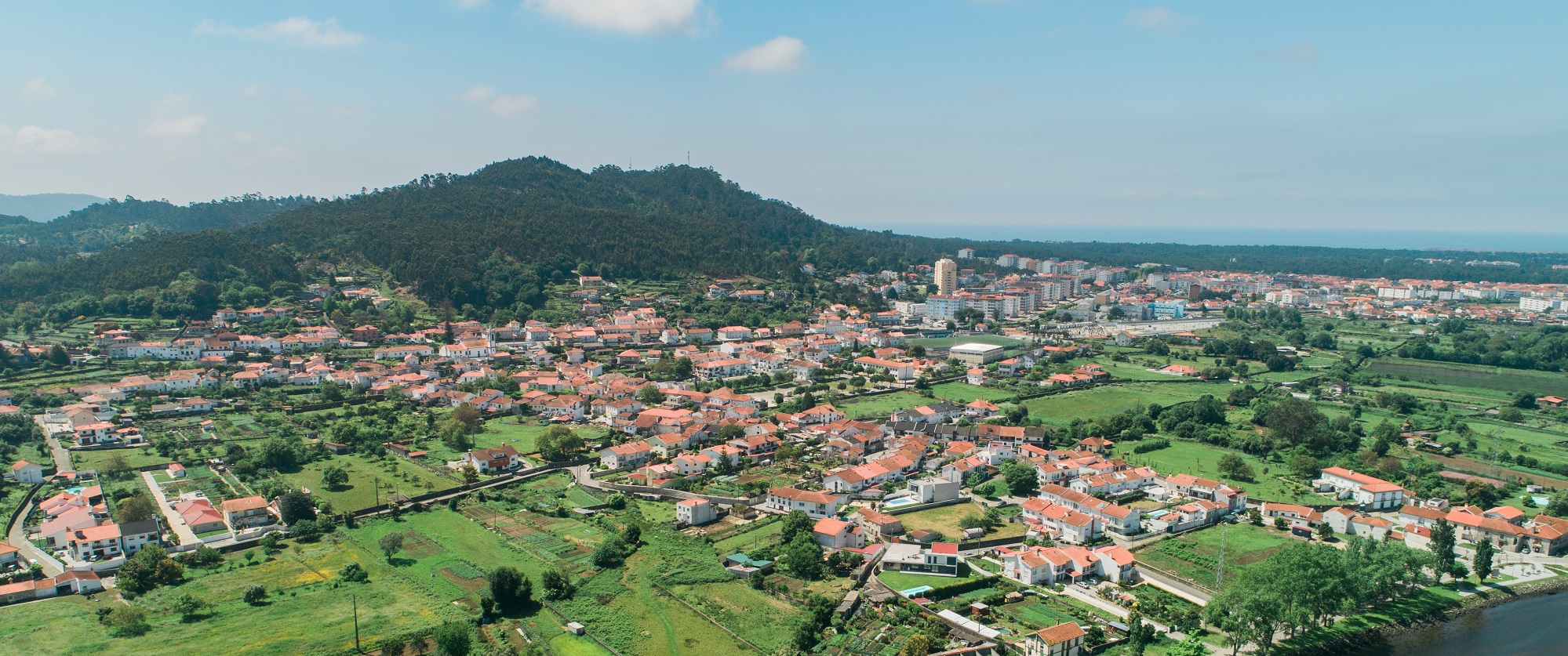
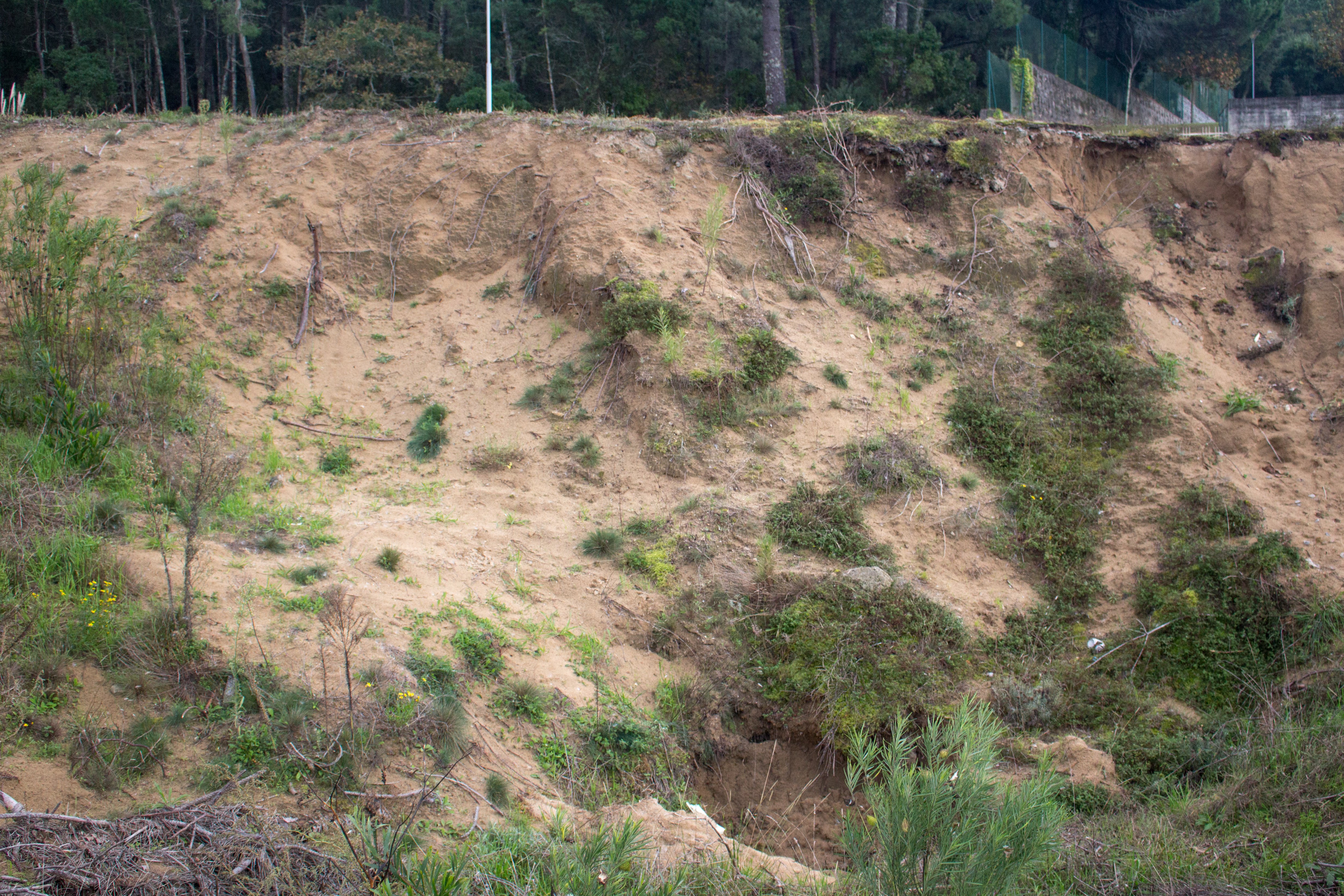
Climbing dunes in Faro de Anha Natural Monument, Viana do Castelo
The Local Natural Monument corresponds to the NE side of the Galeão massif (57 ha), located on the left bank of the mouth of the Lima River. In this area, three flattening surfaces are preserved: Vila Fria Surface (50 m), Ola Surface (75 m) and Faro de Anha Surface (100 m) (Carvalhido, 2012; Carvalhido, 2014a, 2014b, 2014c). These surfaces are regularized by sandy deposits, well calibrated, preserving interlaced stratification and cross lamination by current ripples (Carvalhido, 2012, 2014a, 2014b, 2014c, 2014d). The Areias de Galeão are dune sands deposited at the culmination of the climate crisis of the Little Ice Age (Dalton Minimum) (radiometric dating indicates deposition between the years 1780 and 1800). The typical criss-cross stratification of this unit is clear in some sectors, although sometimes only low-angle beams are observed (Carvalhido, 2012, 2014d). The morphometry and morphoscopy data prove the aeolic origin of the deposits, consisting of grains from rolled to sub-rolled features, with perforated and shiny rounded surfaces. The low humidity conditions, associated with the strong winds that would have been felt during the Dalton Minimum, will have been responsible for the transport and subsequent wind regulation of the Galeão surfaces. Despite the carbonated content of Areias de Galeão, the recent age, the weak thickness of the deposits and the cold conditions (conducive to the dissolution of carbonates) will have prevented their consolidation. Parish memories are an asset with potential for exploring this theme (e.g. disappearance of the parish of Aster under the dune sands). The base of the Areias de Galeão unit (first 20 cm) conserves medium to fine granite clasts, of two micas and biotitic (MPS = 20 cm), subangular (Carvalhido, 2012). Under the dune sands there is the lithostratigraphic unit Areias da Ribeira da Areia, which corresponds to the water availability conditions that precede the Maunder Minimum, which constitutes the period of full installation of the Little Ice Age in Europe. The standard deposits retain some of the sets of frontal ripples with preserved internal structure - tangential to sigmoidal frontal blades, inclined towards NE and dorsal counterflow blades. The OSL dating of the deposits revealed installation between the years 1590 to 1650 (Carvalhido, 2012, 2014c). The available radiometric data, the stratigraphic contact in involution and the decacentimetric clasts of medium grain granite, of 2 micas, angular, in the transition between the two levels, allow to deduce the association of the deposits with climatic evolution until the installation of the Maunder Minimum: the lower level is associated with a medium with available liquid water, associated with currents (Areias da Ribeira da Areia), to degrade the wind deposits at higher levels, later transitioning to cold conditions (signs of cryoturbation in the transition between both units), strong winds but not very humid (Maunder Minimum) (Areias de Galeão) (Carvalhido, 2012).
CHARACTERISTICS
City: Viana do Castelo
Postal Code: 4904 - 877
Telephone: 258821091
Email: geral@geoparquelitoralviana.pt
Website: https://geoparquelitoralviana.pt/
Specific Conditions:
-
Method:
A pé
Difficulty Level:
Baixa
Group Visits:
Yes
Minimum Number of Person per group:
10
Maximum Number of Person per group:
30
Observations:
From 9h00 to 13h00 | From 14h00 to 17h00 By prior appointment.
Guided Tours:
Yes
Observations:
From 9h00 to 13h00 | From 14h00 to 17h00 By prior appointment.
Pedestrian route
-
Activity Program:
-
Study and Research Unit:
-
Audiovisual and Multimedia Resources:
-
Volunteering Programs:
-
Activities available at the educational service of the Viana do Castelo Geopark, to be consulted at https://redeescolardeciencia.pt/, which consist on field trips to the Local Natural Monument for the study of local geoforms and geological landscapes.
Target Audience:
Students from 1º Cycle (KS1) to Secundary Education (KS5)
Activity Cost:
0€
Weekly Schedule:
monday, tuesday, wednesday, thursday, friday
From 09:00:00 to 13:00:00.
From 14:00:00 to 17:00:00.
Weekend and Holidays Schedule:
From 00:00:00 to 00:00:00.
From 00:00:00 to 00:00:00.
Exceptions:
For after-hours visits, please contact us at reservas@geoparquelitoralvianadocastelo.pt.
Observations:
The Educational Service's activities appointment has to be done through the website of the School Network of Science and Scientific Research Support, at https://redeescolardeciencia.pt/.
https://www.geoparquelitoralviana.pt/en/discover/
Cultural Facilities
http://www.cm-viana-castelo.pt/pt/agenda-cultural
Security Forces
http://www.cm-viana-castelo.pt/pt/contatos-uteis
Where to Eat
https://www.geoparquelitoralviana.pt/en/discover/
T. Rodoviário
Agency Name:
AVIC
Telephone Number:
258806180
Type of Transport:
Táxi
Agency Name:
Central de Táxis Coelho, Coelho & Filhos, Lda
Telephone Number:
258776092
Type of Transport:
Táxi
Agency Name:
Táxi Vianense ,Lda.
Telephone Number:
258826641
Type of Transport:
Táxi
Agency Name:
Táxis de Viana, Lda.
Telephone Number:
258829167
Type of Transport:
Táxi
Agency Name:
Táxis Filipe, Lda.
Telephone Number:
258323946
Type of Transport:
Táxi
Agency Name:
Táxis Lutador Unipessoal,Lda.
Telephone Number:
258111222
Parking for private vehicles:
Yes
The Casa dos Nichos (House of the Niches) is a 15th century building recently restored to receive an exhibition area here you can see part of the county's archaeological estate, highlighting the Prehistory, Iron Age and Romanization period. ith a strong pedagogical vocation, the visitor has available multimedia means to access information about cultural heritage such as the city of Santa Luzia, Santa Maria de Geraz de Limas’s medieval graves of Carreço’s rock engravings.
gps: 41.691771 -8.828048
distance: 0km
Citânia de Santa Luzia (Santa Luzia fortified village)
The Citânia de Santa Luzia, locally knon as the "old ton", is one of the best knon castres of northern Portugal and undoubtedly one of the most important for the study of Protohistory and Romainzation of the Alto Minho. Its strategic location not only alloed it to dominate vast areas of the riverside area, but also to control the movement of entrances and exits in Foz do Lima hich, in antiquity, ould be navigable for much of its course.
gps: 41.705642 -8.833617
distance: 0km
Montedor's Lighthouse
The Montedor's Lighthouse is located on a promontory in Montedor, about 4 nautical miles north of the Lima river mouth and 7 miles south of the Minho river mouth, in the parish of Carreço, ton and district of Viana do Castle in Portugal. It is the northernmost lighthouse in the country and ent into operation on March 20, 1910. It on a square toer in granite stone ith a height of 28 meters and 103 meters altitude above sea level. In addition to its museological interest, the Farol de Montedor provides an incredible vie of the surrounding area, here you can see the entire coastline zone from Areosa to Vila Praia de Âncora, as ell the surrounding lolands.
gps: 41.751657 -8.873417
distance: 10km
Gil Eannes Hospital Ship
The Gil Eannes Hospital Ship as built in Viana do Castelo in 1955, and supported for decades, the Portuguese cod fleet that operated in Nefoundland and Greenland. hen the cod fleet as deactivated, the ship as left to rot at Lisbon docks for many years. On January 31 of 1998, the ship as festively elcomed in Foz do Lima. After cleaned and restored, the ship opened to the public on August 19 of 1998, turning into a pole of attraction for Viana do Castelo.
gps: 41.690119 -8.830309
distance: 0km


