Home /
Arouca Geopark /
Costa da Castanheira Viewpoint (Geosite) - Radar Meteorológico de Arouca, Castanheira

Costa da Castanheira Viewpoint (Geosite) - Radar Meteorológico de Arouca, Castanheira
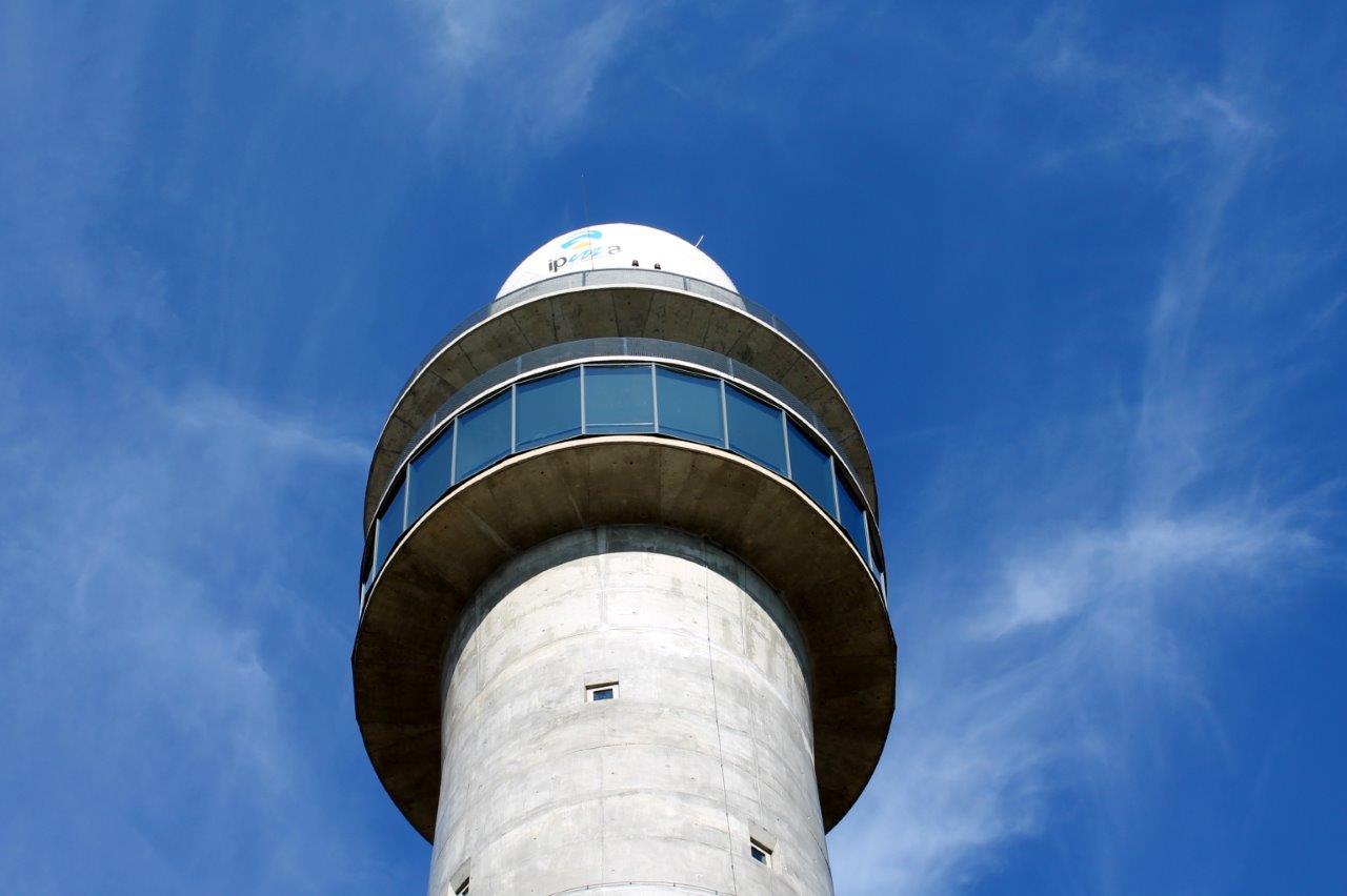
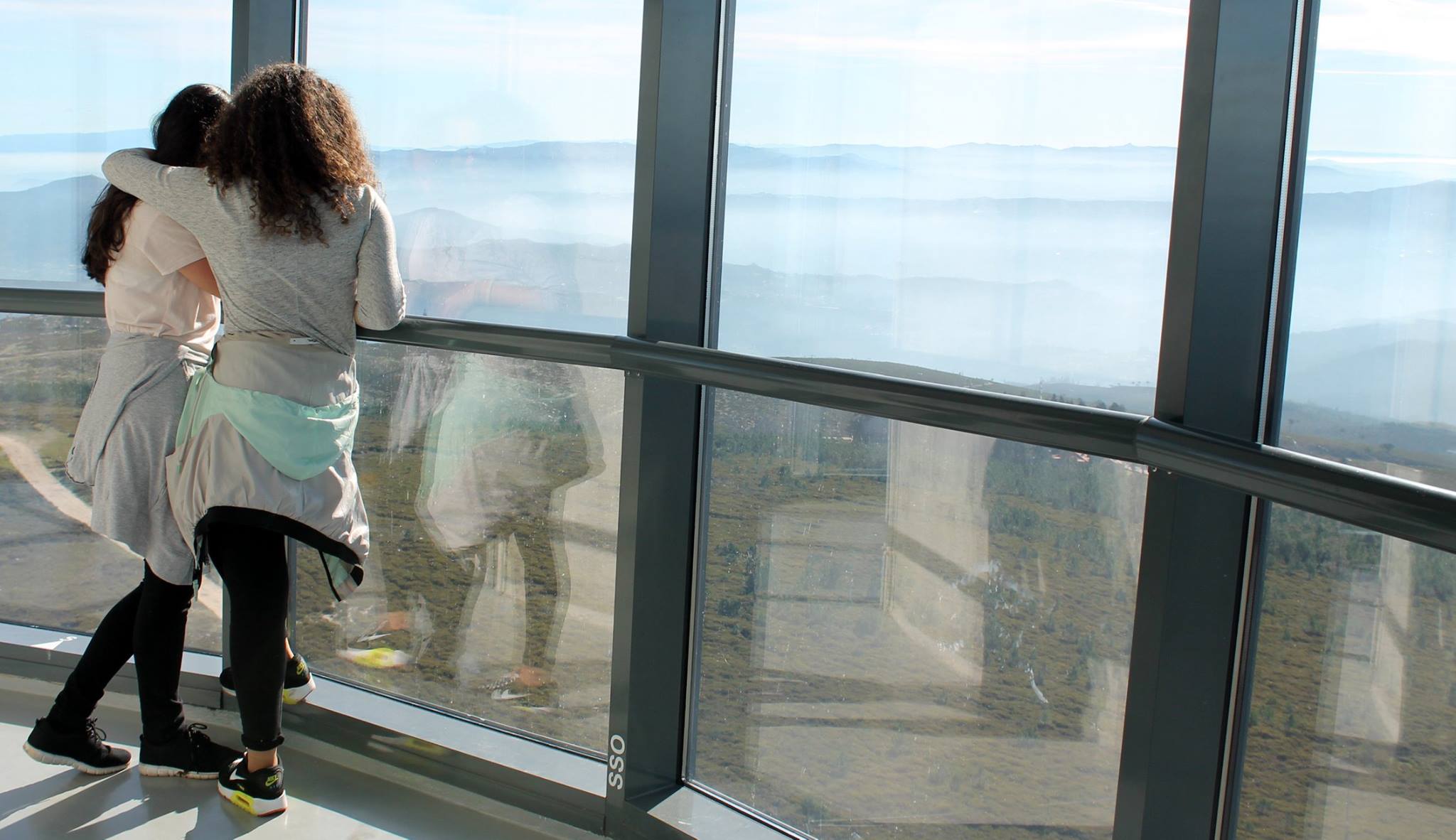
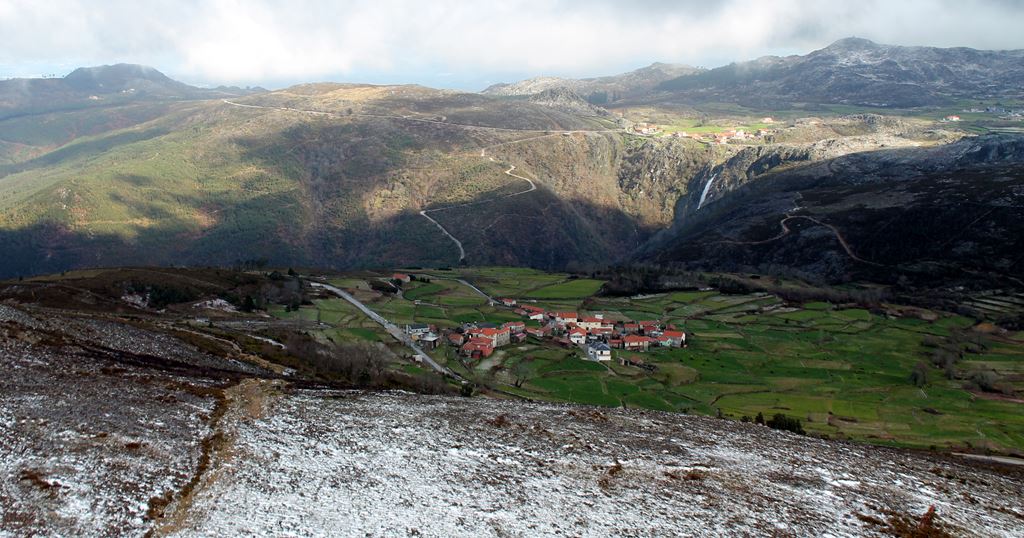
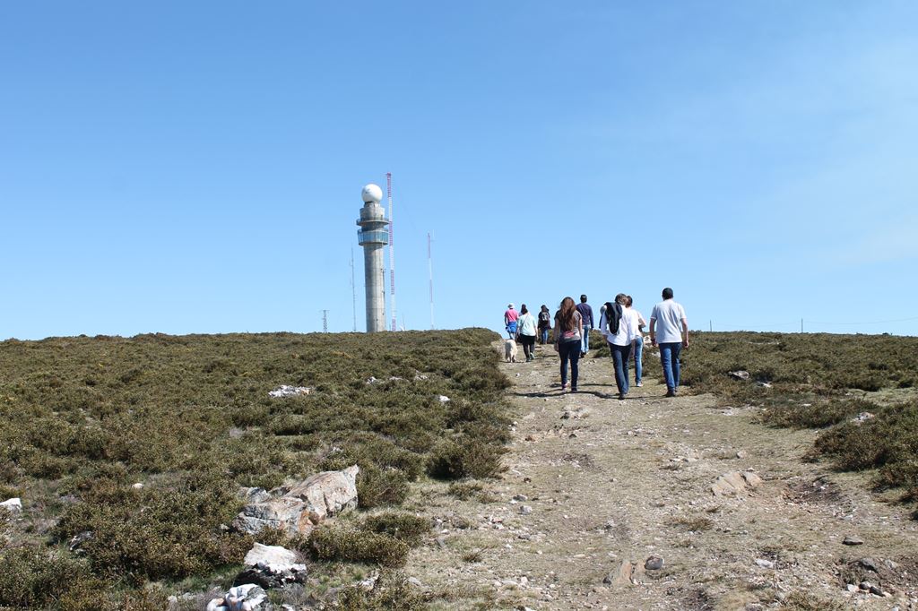
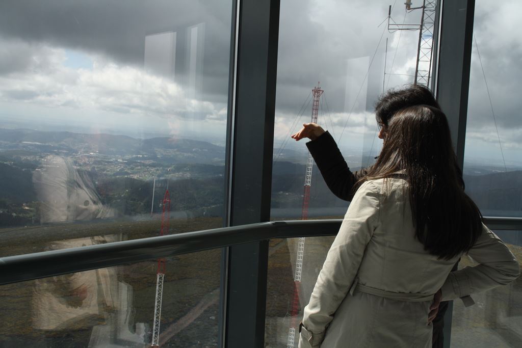
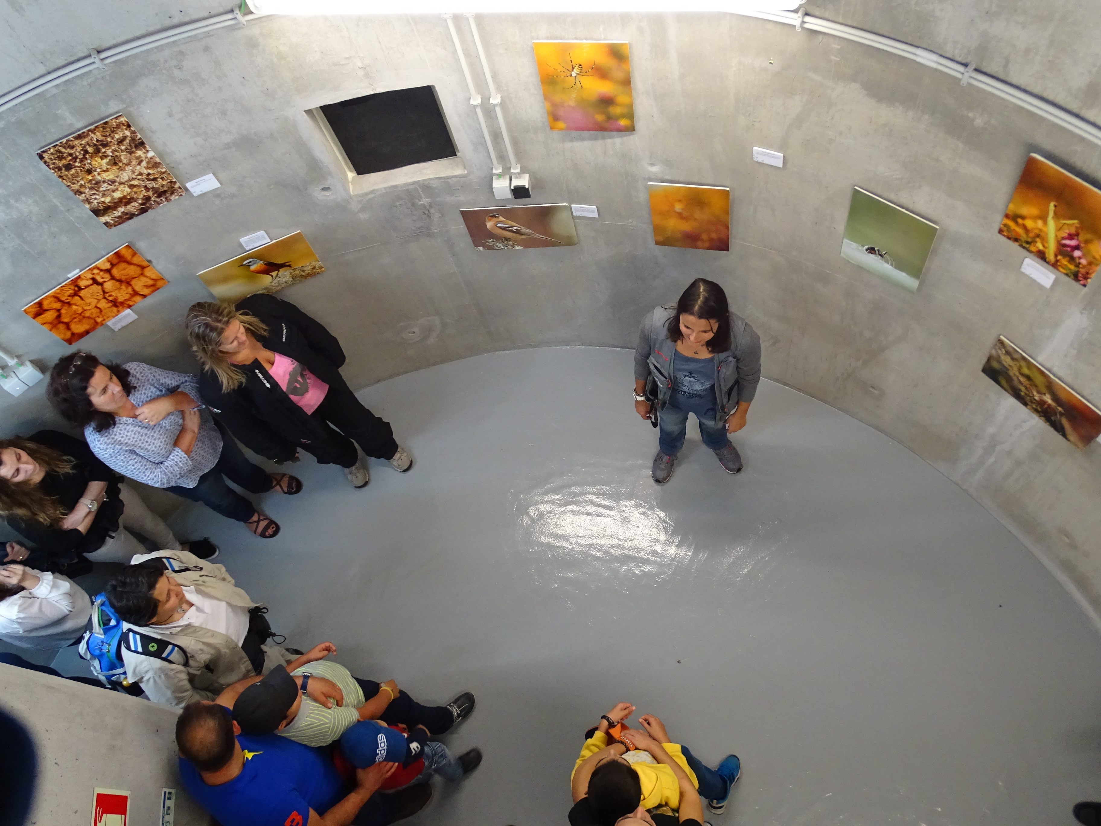
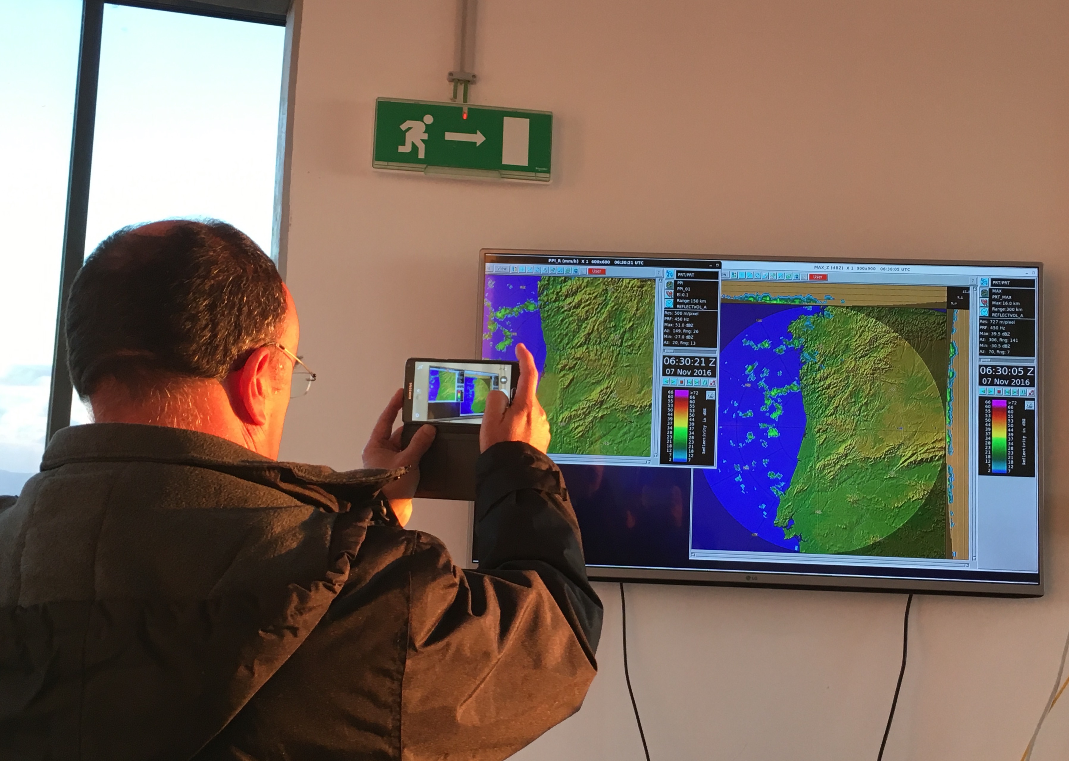
In Serra da Freita, near the village of Castanheira, you can rise to the Panoramic Floor of the Arouca Meteorological Radar (10th floor) and understand the operation of this technical infrastructure, at the service of the Portuguese Institute of Sea and Atmosphere (IPMA), while delighting in the excellence of the surrounding landscapes that our territory has to offer you. This building is located in the "Costa da Castanheira viewpoint" geosite (G10) and allows you to observe, on clear days, an important area of ??the national territory, especially the Arada, Caramulo, Estrela, Montemuro, the Vouga Valley, the Atlantic Ocean (namely the coast line from the region of Aveiro to Porto), the urban areas of Gaia, Porto and Aveiro and the whole plateau area of ??Serra da Freita, in particular «Frecha da Mizarela», the largest waterfall from mainland Portugal. From the technical point of view, this infrastructure is the latest and most modern radar in Portugal, inaugurated on February 18, 2015 allowing to obtain updated information and improve the weather forecast
CHARACTERISTICS
LOCATION
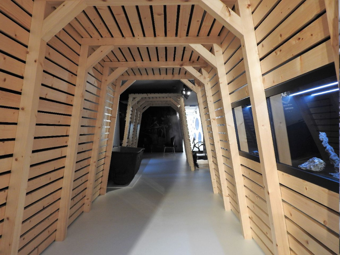
Address: Information and markings: Casa das Pedras Parideiras – Centro de Interpretação Rua de Santo António, Castanheira – Serra da Freita
City: Castanheira
Postal Code: 4540 - 012
Telephone: 256484093
Email: pedrasparideiras@aroucageopark.pt
Website: http://www.aroucageopark.pt
City: Castanheira
Postal Code: 4540 - 012
Telephone: 256484093
Email: pedrasparideiras@aroucageopark.pt
Website: http://www.aroucageopark.pt
FUNCTIONING
Weekly Schedule:
From 00:00:00 to -.
From 00:00:00 to -.
Weekend and Holidays Schedule:
From 00:00:00 to 00:00:00.
From 14:00:00 to 17:00:00.
Exceptions:
Whenever the weather forecasts are for precipitation and / or fog, the space is closed.
Paid Entry:
2€
Discount Policy:
-
From 00:00:00 to -.
From 00:00:00 to -.
Weekend and Holidays Schedule:
From 00:00:00 to 00:00:00.
From 14:00:00 to 17:00:00.
Exceptions:
Whenever the weather forecasts are for precipitation and / or fog, the space is closed.
Paid Entry:
2€
Discount Policy:
-
ORGANISATION OF THE VISIT
The visit to this Point requires prior booking and can be done individually.
Specific Conditions:
Individual visits on Saturdays and Sundays from 14:00 às 17:00
Method:
-
Difficulty Level:
-
Group Visits:
Yes
Minimum Number of Person per group:
10
Maximum Number of Person per group:
50
Observations:
9:30- 12:30 / 14:00 - 17:00
Guided Tours:
Yes
Observations:
Whenever the main weather conditions of capture and / or fog, or the space is closed. It is possible to make a visit from Monday to Friday, as well as Saturdays and Sundays in the morning, by appointment, 5 working days in advance, for groups under 10 people. Booking contacts: Casa das Pedras Parideiras - pedrasparideiras@aroucageopark.pt
EXISTING EQUIPMENT
MUSEUM / INTERPRETATION CENTER
Museum / Interpretation Center History:
-
Activity Program:
-
Study and Research Unit:
-
Audiovisual and Multimedia Resources:
-
Volunteering Programs:
-
-
Activity Program:
-
Study and Research Unit:
-
Audiovisual and Multimedia Resources:
-
Volunteering Programs:
-
EDUCATIONAL SERVICE
Activity Description:
View information at http://www.aroucageopark.pt/pt/aprender/programas-educativos/
Target Audience:
Students
Activity Cost:
4€
Weekly Schedule:
monday, tuesday, wednesday, thursday, friday
From 09:30:00 to 12:30:00.
From 14:00:00 to 17:00:00.
Weekend and Holidays Schedule:
saturday, sunday, holidays
From 09:30:00 to 12:30:00.
From 14:00:00 to 17:00:00.
Exceptions:
Reservation required 5 working days in advance.
Observations:
http://www.aroucageopark.pt/
EXTERNAL SUPPORT
Where to Eat
http://naturveredas.com/
Where to Stay
http://aroucageopark.pt/pt/explorar/onde-dormir/
Cultural Facilities
http://aroucageopark.pt/pt/planear/contactos-uteis/loja-interativa-de-turismo/
Security Forces
https://www.sns.gov.pt/entidades-de-saude/agrupamento-de-centros-de-entre-douro-e-vouga-i-feiraarouc
TRANSPORT
Type of Transport:
Táxi
Agency Name:
Praça de táxis de Arouca
Telephone Number:
256944424
Parking for private vehicles:
Yes
Táxi
Agency Name:
Praça de táxis de Arouca
Telephone Number:
256944424
Parking for private vehicles:
Yes
SITES OF TOURISTIC INTEREST
Albergaria da Serra Recreation and Leisure Area
Near the village of Albergaria da Serra the river Caima invites to moments of relax and contact ith nature.
gps: 40.86533 -8.27743
distance: 0km
Dolmen of Portela da Anta
On the Freita plateau, Portela da Anta ill probably be the most accessible megalithic monument in the territory. Surprising by its volume and the uniformity ith hich it develops from a small grave. Dating back to the end of the fourth millennium BC, it is curiously inserted in the beautiful surrounding landscape, in an interesting combination beteen life, reneed by nature ith each cycle, and death, hich may not mean the end of everything.
gps: 40.860599 -8.26168
distance: 0km
Merujal Biodiversity Station
Merujal's Biodiversity Station (EBIO) is located in Serra da Freita and is composed by nine information panels about the local biodiversity. Starting next to the Merujal camping park, EBIO crosses, for 1.7 km long, several types of terrestrial habitats (pine forest, scrub, oak oods) and freshater habitats (streams and peatlands), ending near the geosite «Frecha da Mizarela»
gps: 40.873205 -8.291827
distance: 0km
Loja Interativa de Turismo de Arouca
Inaugurated on September 19, 2013, the «Loja Interativa de Turismo de Arouca» is located in the center of the village, in the ancient «Globo D´Ouro cinema». This is one of the shops of the Porto and Northern Portugal Tourism Region and one of the entrance doors of Arouca Geopark, being an informative, educational and space for several activities.
gps: 40.92926 -8.24816
distance: 0km
ASSOCIATED ROUTES
Geoparks in Portugal
Geoparks in Portugal UNESCO World Geoparks are territories with locations and landscapes of international geological importance, which combine the protection and promotion of its heritage with sustainable development. They are unique places where the oldest memories are millions of years old and include key locations that testify to the evolution of our planet. These territories are classified by UNESCO under the International Geosciences and Geoparks Program. Spread across all continents, geoparks are much more than areas of heritage relevance. They are dynamic territories of which local communities are part, where nature, history and culture are intertwined. There are currently 5 UNESCO World Geoparks in Portugal: Naturtejo (2006), Arouca (2009), Azores (2012), Terras de Cavaleiros (2014) and Estrela (2020). The Geopark on the coast of Viana do Castelo is preparing the future application, but its level of implementation in the territory, namely the educational offer it already develops, led to its inclusion in the GUIDE OF THE PORTUGUESE GEOLOGICAL AND MINES SITES, naturally without the status that UNESCO gives to the remaining territories. On the other hand, new applications are being developed, with several projects in the Oeste, Algarve and Figueira da Foz, which in due time may have their presence on this platform. To visit Portuguese geoparks is to embark on a journey that began 600 million years ago, when Portugal occupied a very different place on the globe, going through incredible episodes of formation and destruction of mountains and seas, of the appearance and extinction of species, of the occurrence of deep climate change, major volcanic eruptions ... until today in the relationship between man and the planet On this GUIDE the visitor will find a proposed itinerary to visit the most significant points in each national geopark, including, of course, the one located in the Autonomous Region of the Azores. Take a "good trip" on the GUIDE OF THE PORTUGUESE GEOLOGICAL AND MINES SITES and discover the interesting places we introduce you throughout the country.
Geoparks in Portugal UNESCO World Geoparks are territories with locations and landscapes of international geological importance, which combine the protection and promotion of its heritage with sustainable development. They are unique places where the oldest memories are millions of years old and include key locations that testify to the evolution of our planet. These territories are classified by UNESCO under the International Geosciences and Geoparks Program. Spread across all continents, geoparks are much more than areas of heritage relevance. They are dynamic territories of which local communities are part, where nature, history and culture are intertwined. There are currently 5 UNESCO World Geoparks in Portugal: Naturtejo (2006), Arouca (2009), Azores (2012), Terras de Cavaleiros (2014) and Estrela (2020). The Geopark on the coast of Viana do Castelo is preparing the future application, but its level of implementation in the territory, namely the educational offer it already develops, led to its inclusion in the GUIDE OF THE PORTUGUESE GEOLOGICAL AND MINES SITES, naturally without the status that UNESCO gives to the remaining territories. On the other hand, new applications are being developed, with several projects in the Oeste, Algarve and Figueira da Foz, which in due time may have their presence on this platform. To visit Portuguese geoparks is to embark on a journey that began 600 million years ago, when Portugal occupied a very different place on the globe, going through incredible episodes of formation and destruction of mountains and seas, of the appearance and extinction of species, of the occurrence of deep climate change, major volcanic eruptions ... until today in the relationship between man and the planet On this GUIDE the visitor will find a proposed itinerary to visit the most significant points in each national geopark, including, of course, the one located in the Autonomous Region of the Azores. Take a "good trip" on the GUIDE OF THE PORTUGUESE GEOLOGICAL AND MINES SITES and discover the interesting places we introduce you throughout the country.
SUGGESTIONS OF THE ROUTE- OTHER NEARBY PLACES TO VISIT
Braçal and Malhada Mines
The Braçal mining complex includes the Braçal, Malhada and Coval da Mó mines and extends along the Mau River, on the eastern slope of the Serra do Braçal. This complex is the oldest Portuguese mining concession, registered under number 1, a ...
Municipal Museum
It tells the story of a territory, disclosing its heritage and elements of cultural and ethnographic interest. It is also a place where one investigates, protects and learns about Sever do Vouga's heritage. It approaches Archeology in Terra ...
Stone Museum of Marco de Canaveses
The Stone Museum of Marco de Canaveses is more than what you see. The permanent exhibition is the first step of a project to extend the Museum to other places. In the future it will be a polynuclear museum. Larger, dynamic and innovative. ...