Home /
Arouca Geopark /
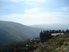
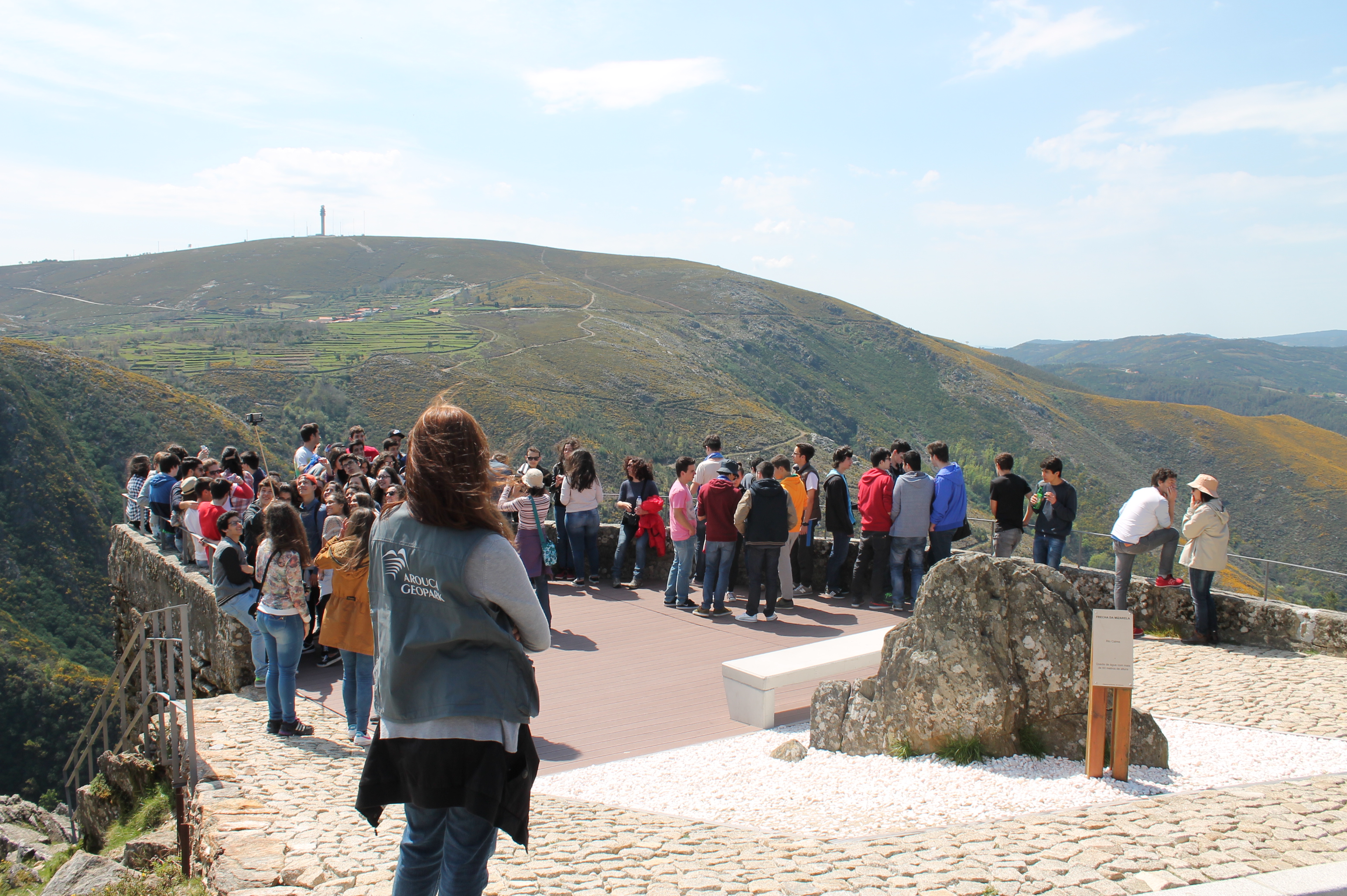
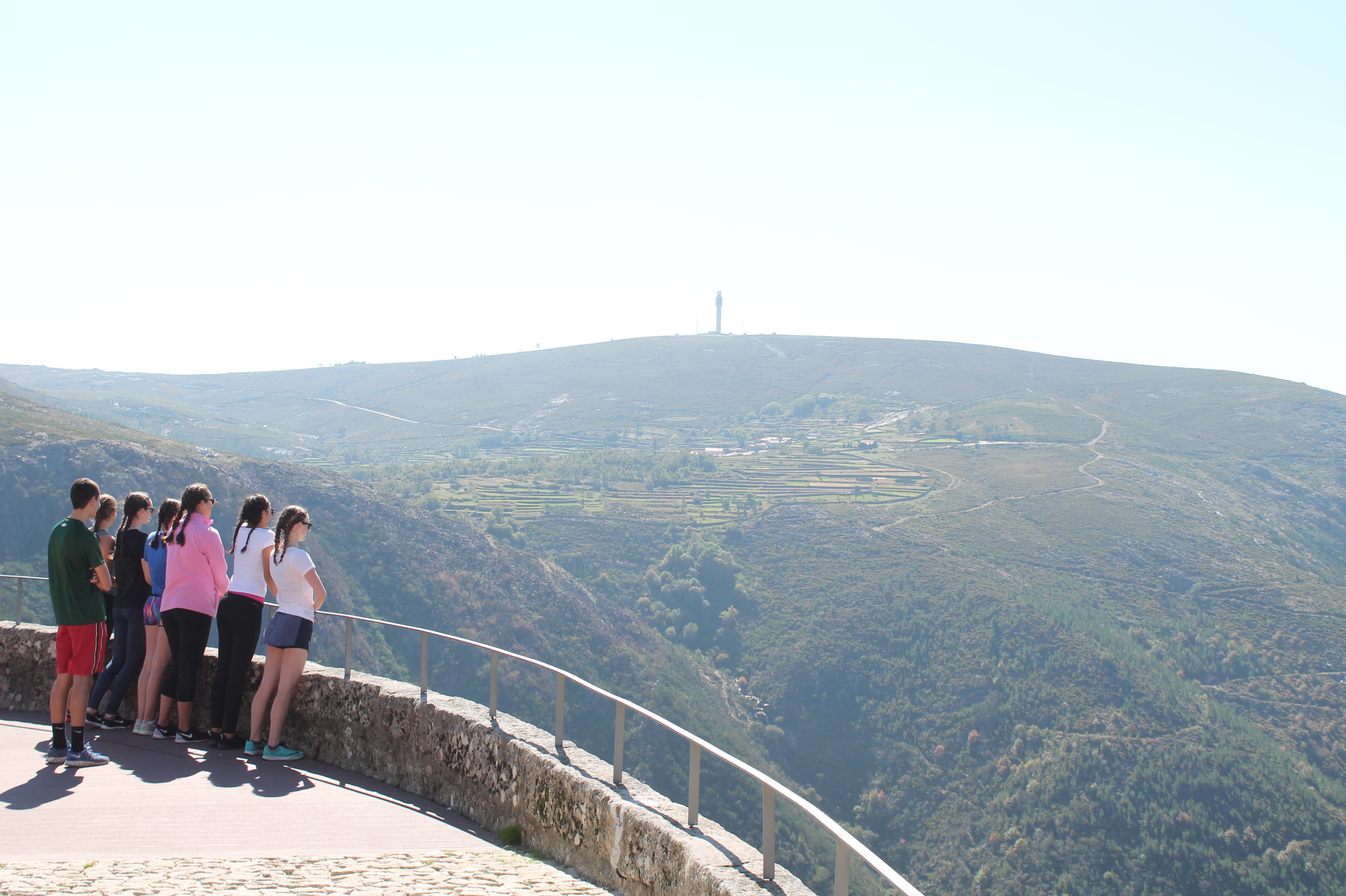
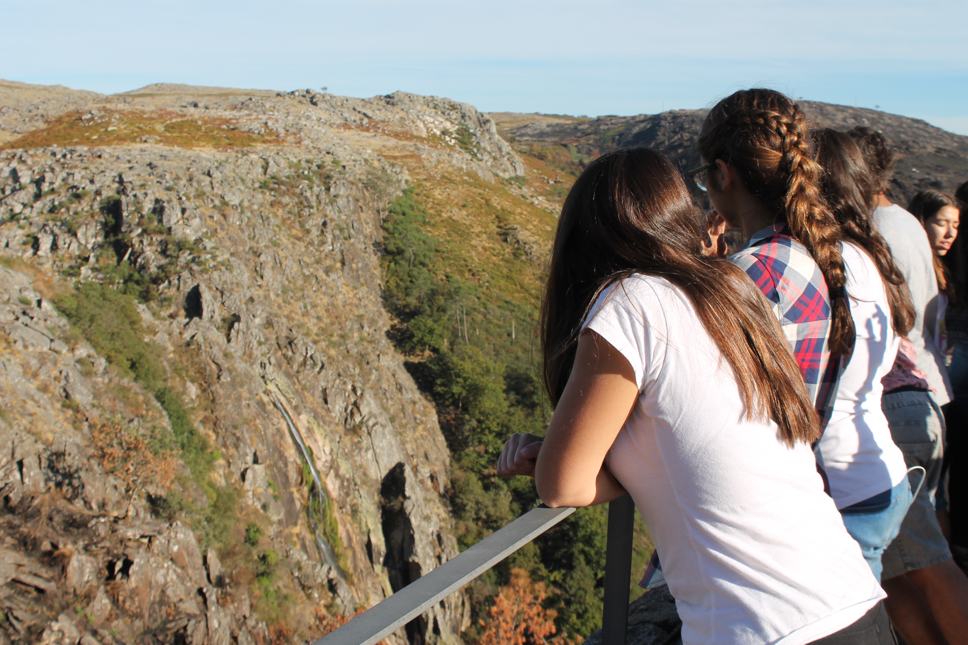
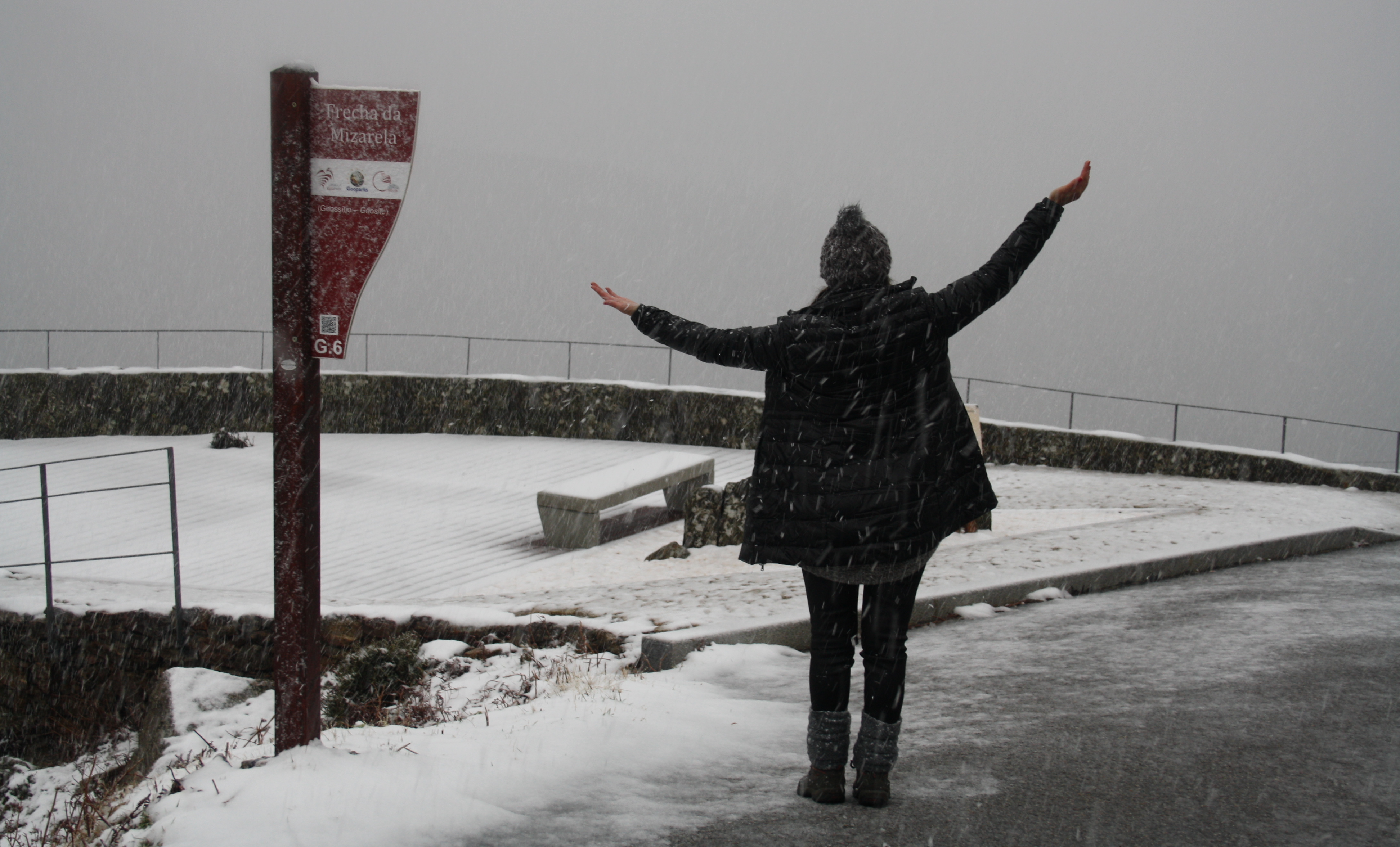
Frecha da Mizarela Overview (Geosite), Albergaria da Serra
Frecha da Mizarela Overview (Geosite), Albergaria da Serra
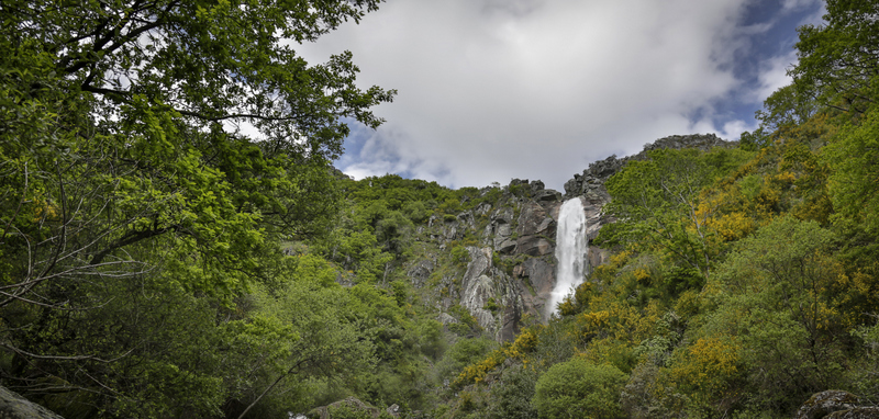
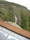
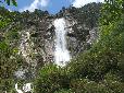
Panoramic view, of national importance, where the highest waterfall of Portugal can be seen, located at the contact between the Serra da Freita granite and the ante-Ordovician metasediments (schists and greywackes). As granite is more resistant to the fluvial erosion of the Caima river than the metasediments, over time a notable drop of over 70 metres was formed, thus originating the Frecha da Mizarela. In addition to the difference in resistance to erosion, it is also believed that the direction of the system of faults which affect the entire Serra da Freita block, may have directly influenced the formation of this unique cliff.


CHARACTERISTICS
LOCATION
Address: Mizarela
City: Albergaria da Serra
Postal Code: 4540 - 000
Telephone: 256940254
Email: geral@aroucageopark.pt
Website: http://www.aroucageopark.pt/
City: Albergaria da Serra
Postal Code: 4540 - 000
Telephone: 256940254
Email: geral@aroucageopark.pt
Website: http://www.aroucageopark.pt/
FUNCTIONING
Public venue, with no timetable or entrance fee.
ORGANISATION OF THE VISIT
The visit to this Point requires prior booking and can be done individually.
Specific Conditions:
Visitas turísticas: marcação através de www.aroucageopark.pt
Method:
Transporte organização
Difficulty Level:
Low
Group Visits:
Yes
Minimum Number of Person per group:
8
Maximum Number of Person per group:
30
Observations:
-
Guided Tours:
Yes
Observations:
Reservations 8 days in advance
EXISTING EQUIPMENT
Geological curiosity
GEOLOGICAL / MINING INTEREST
History Patrimony:
-
Activity Program:
-
Study and Research Unit:
-
Audiovisual and Multimedia Resources:
-
Volunteering Programs:
-
-
Activity Program:
-
Study and Research Unit:
-
Audiovisual and Multimedia Resources:
-
Volunteering Programs:
-
EDUCATIONAL SERVICE
Activity Description:
Desde o ano letivo 2008/2009 que a AGA - Associação Geoparque Arouca desenvolve Programas Educativos em toda a área do concelho de Arouca, abrangendo diversas áreas do saber: Geologia, Biologia, Geografia, História, Turismo, entre outros. Consulte a oferta em http://www.geoparquearouca.com/?p=programas
Target Audience:
From primary schools to university. .
Activity Cost:
0.0002€
Weekly Schedule:
monday, tuesday, wednesday, thursday, friday
From 09:00:00 to 12:30:00.
From 14:00:00 to 17:30:00.
Weekend and Holidays Schedule:
saturday, sunday, holidays
From 09:30:00 to 12:30:00.
From 14:00:00 to 17:30:00.
Exceptions:
-
Observations:
http://www.geoparquearouca.com/?p=programas
EXTERNAL SUPPORT
Security Forces
http://www.min-saude.pt/Portal/servicos/prestadoresV2/?providerid=344
Where to Stay
http://www.geoparquearouca.com/?p=turismo
Where to Stay
http://www.geoparquearouca.com/?p=turismo&sp=turismoalojamento
Where to Eat
http://www.geoparquearouca.com/?p=turismo&sp=turismorestauracao
Cultural Facilities
http://www.geoparquearouca.com/?p=turismo&sp=turismoanimacao
TRANSPORT
Type of Transport:
Táxi
Agency Name:
Praça de táxis de Arouca
Telephone Number:
256944424
Parking for private vehicles:
Yes
Táxi
Agency Name:
Praça de táxis de Arouca
Telephone Number:
256944424
Parking for private vehicles:
Yes
SITES OF TOURISTIC INTEREST
Albergaria da Serra river beach
The "Albergaria da Serra" river beach, on the river Caima and located near the village "Albergaria da Serra", invites to moments of relax and of contact with nature.
gps: 40.86533 -8.27743
distance: 0km
Traditional Village of Cabaços
Located in the idyllic landscape of the Freita Mountain, in the village of Castanheira, it is still possible to find the hardiness, traditions and history of the inhabitants of Arouca, closely linked to agriculture.
gps: 40.85985 -8.27443
distance: 0km
Traditional Village of Castanheira
Located in the idyllic landscape of the Freita Mountain, in the village of Castanheira, it is still possible to find the hardiness, traditions and history of the inhabitants of Arouca, closely linked to agriculture. In its surroundings we find the famous geosite "Stones that give birth", so-called by the local inhabitants.
gps: 40.85187 -8.28193
distance: 5km
Monastery of Arouca
Rated as a national monument, the current set of the monastery dates from the XVII and XVIII centuries. Considered the largest granite monument built in Portugal, the Monastery has arisen in the century X, being a mixed community and being under the Benedictine Order. In 1210, the monastery is bequest to D. Mafalda, by his father D. Sancho I, King of Portugal. In the century XIII the Order of St. Benedict is replaced by the Cistercian Order, which continued until the end of the century XIX.
gps: 40.92805 -8.24654
distance: 0km
Sacred Art Museum
Established by the Royal Brotherhood of Santa Mafalda Queen's, the Sacred Art Museum occupies most of the Arouca Monastery. It is considered one of the best particular museums, of its kind in the Iberian Peninsula, where, in addition to multiple objects of worship, vestments, furniture and liturgical manuscripts, can be found rare pieces of sculpture, painting, tapestry and jeweler.
gps: 40.92805 -8.24654
distance: 0km
Municipal Museum of Arouca
Opened in 2008 and located just in the entry of the village of Arouca, the Arouca Municipal Museum displays the ethnographic exhibition "Memories of a Rural Life," still contemplating an area dedicated to archeology and geology. It receives with regularity temporary exhibitions.
gps: 40.92755 -8.24962
distance: 15km
Casa da Ribeira (Sede da AGA)
A "Casa da Ribeira", situada em pleno centro histórico da vila de Arouca, é uma das poucas que resta do núcleo habitacional do séc. XVII. Sobre uma das portas pode encontrar-se a inscrição em latim "NON SINE INVIDIA ANNO 1686", que poderá traduzir-se em "Não sem inveja, ano de 1686). Nesta está instalada a sede da AGA - Associação Geoparque Arouca.
gps: 40.92912 -8.2458
distance: 15km
Geological Interpretative Centre of Canelas (CIGC)
O CIGC exibe uma singular coleção de fósseis, recolhidos nas ardósias aflorantes na Pedreira do Valério, situada nas imediações. Desta excecional coleção paleontológica, referenciada internacionalmente, merece particular destaque o acervo de Trilobites com uma idade estimada em 465 milhões de anos que, para além da sua excecionalidade científica, algumas das espécies correspondem aos maiores exemplares do mundo encontrados. Mais informações em http://www.cigc-arouca.com/ .
gps: 40.96208 -8.21717
distance: 0km
Senhora da Mó Mount
At an altitude of 711 m, from the top of "Senhora da Mó" Mount can be get a panoramic view over the valley of Arouca and Moldes and the mountains of Freita and Gamarão. Here is also possible to find the chapel dedicated to "Mó" Lady, with characteristic contours and which is thought to be the century XVI. The celebrations in honor of the patron take place in 7 and 8 September.
gps: 40.93287 -8.22511
distance: 21km
Casa das Pedras Parideiras - Centro de Interpretação
A 3 de novembro de 2012 foi inaugurada a Casa das Pedras Parideiras - Centro de Interpretação. Este é um equipamento que pretende contribuir para a conservação, compreensão e valorização deste importante património geológico, assim como promover a sua visitação turística e educativa. Do ponto de vista geológico, este geossítio corresponde a um pequeno corpo granítico, com a área aproximada de 1 km2 e uma idade estimada em 313-320 Ma, conhecido por Granito nodular da Castanheira.
gps: 40.85089 -8.28257
distance: 0km
Loja Interativa de Turismo de Arouca
Inaugurada no dia 19 de setembro de 2013, a Loja Interativa de Turismo de Arouca localiza-se no centro da vila, no antigo cinema Globo D ´Ouro. Esta é uma das Lojas da Região de Turismo do Porto e Norte de Portugal e uma das portas de entrada do Arouca Geopark, sendo um espaço informativo, educativo e de realização de diversas atividades.
gps: 40.92926 -8.24816
distance: 0km
Pedras Boroas do Junqueiro
No relevo residual granítico do planalto da Serra da Freita destacam-se dois blocos arrendondados que exibem uma fissuração poligonal bem expressiva, assemelhando-se à côdea da broa.
gps: 40.846898 -8.271856
distance: 0km
Radar Meteorológico de Arouca
Nas proximidades das Pedras Parideiras podemos conhecer o Radar Meteorológico de Arouca. O seu piso panorâmico (Piso 10) é um magnífico ponto de observação da morfologia e paisagem da Serra da Freita, mas também da zona litoral entre a Serra da Boa Viagem e a região da Póvoa do Varzim e as Serras de Montemuro, Arada, Estrela e Caramulo, entre outros. Em complementaridade nesta infraestrutura propriedade do IPMA é possível conhecer o seu funcionamento técnico.
gps: 40.844792 -8.27978
distance: 0km
Campo de Dobras da Castanheira
Nas imediações da Casa das Pedras Parideiras encontramos o geossítio de relevância nacional «Campo de Dobras da Castanheira». Aqui são facilmente identificadas rochas xistentas e filões de quartzo fortemente dobrados.
gps: 40.846898 -8.271856
distance: 0km
Miradouro de S.Pedro Velho
O marco geodésico de S. Pedro Velho impõe-se no planalto da Serra da Freita, marcando uma altitude de 1077m. Deste local de interesse geomorfológico, localizado sob um domo rochoso granítico, é possível observar a 360 graus a região norte e centro de Portugal Continental, e em grande destaque a superfície aplanada da Serra da Freita.
gps: 40.875175 -8.280734
distance: 0km
Miradouro do Detrelo da Malhada
Na área do Parque Eólico da Serra da Freita, junto à torre de vigia dos fogos florestais, encontrará o Miradouro do Detrelo da Malhada. Deste geossítio de interesse petrológico e geomorfológico avista-se parte da encosta norte da Serra da Freita, sendo visível o vale de Arouca e a área do Grande Porto, bem como a Serra de Montemuro, entre outras.
gps: 40.885543 -8.255099
distance: 0km
ASSOCIATED ROUTES
Geoparks in Portugal
Geoparks in Portugal UNESCO World Geoparks are territories with locations and landscapes of international geological importance, which combine the protection and promotion of its heritage with sustainable development. They are unique places where the oldest memories are millions of years old and include key locations that testify to the evolution of our planet. These territories are classified by UNESCO under the International Geosciences and Geoparks Program. Spread across all continents, geoparks are much more than areas of heritage relevance. They are dynamic territories of which local communities are part, where nature, history and culture are intertwined. There are currently 5 UNESCO World Geoparks in Portugal: Naturtejo (2006), Arouca (2009), Azores (2012), Terras de Cavaleiros (2014) and Estrela (2020). The Geopark on the coast of Viana do Castelo is preparing the future application, but its level of implementation in the territory, namely the educational offer it already develops, led to its inclusion in the GUIDE OF THE PORTUGUESE GEOLOGICAL AND MINES SITES, naturally without the status that UNESCO gives to the remaining territories. On the other hand, new applications are being developed, with several projects in the Oeste, Algarve and Figueira da Foz, which in due time may have their presence on this platform. To visit Portuguese geoparks is to embark on a journey that began 600 million years ago, when Portugal occupied a very different place on the globe, going through incredible episodes of formation and destruction of mountains and seas, of the appearance and extinction of species, of the occurrence of deep climate change, major volcanic eruptions ... until today in the relationship between man and the planet On this GUIDE the visitor will find a proposed itinerary to visit the most significant points in each national geopark, including, of course, the one located in the Autonomous Region of the Azores. Take a "good trip" on the GUIDE OF THE PORTUGUESE GEOLOGICAL AND MINES SITES and discover the interesting places we introduce you throughout the country.
Geoparks in Portugal UNESCO World Geoparks are territories with locations and landscapes of international geological importance, which combine the protection and promotion of its heritage with sustainable development. They are unique places where the oldest memories are millions of years old and include key locations that testify to the evolution of our planet. These territories are classified by UNESCO under the International Geosciences and Geoparks Program. Spread across all continents, geoparks are much more than areas of heritage relevance. They are dynamic territories of which local communities are part, where nature, history and culture are intertwined. There are currently 5 UNESCO World Geoparks in Portugal: Naturtejo (2006), Arouca (2009), Azores (2012), Terras de Cavaleiros (2014) and Estrela (2020). The Geopark on the coast of Viana do Castelo is preparing the future application, but its level of implementation in the territory, namely the educational offer it already develops, led to its inclusion in the GUIDE OF THE PORTUGUESE GEOLOGICAL AND MINES SITES, naturally without the status that UNESCO gives to the remaining territories. On the other hand, new applications are being developed, with several projects in the Oeste, Algarve and Figueira da Foz, which in due time may have their presence on this platform. To visit Portuguese geoparks is to embark on a journey that began 600 million years ago, when Portugal occupied a very different place on the globe, going through incredible episodes of formation and destruction of mountains and seas, of the appearance and extinction of species, of the occurrence of deep climate change, major volcanic eruptions ... until today in the relationship between man and the planet On this GUIDE the visitor will find a proposed itinerary to visit the most significant points in each national geopark, including, of course, the one located in the Autonomous Region of the Azores. Take a "good trip" on the GUIDE OF THE PORTUGUESE GEOLOGICAL AND MINES SITES and discover the interesting places we introduce you throughout the country.
SUGGESTIONS OF THE ROUTE- OTHER NEARBY PLACES TO VISIT
Braçal and Malhada Mines
The Braçal mining complex includes the Braçal, Malhada and Coval da Mó mines and extends along the Mau River, on the eastern slope of the Serra do Braçal. This complex is the oldest Portuguese mining concession, registered under number 1, a ...
Municipal Museum
It tells the story of a territory, disclosing its heritage and elements of cultural and ethnographic interest. It is also a place where one investigates, protects and learns about Sever do Vouga's heritage. It approaches Archeology in Terra ...
Stone Museum of Marco de Canaveses
The Stone Museum of Marco de Canaveses is more than what you see. The permanent exhibition is the first step of a project to extend the Museum to other places. In the future it will be a polynuclear museum. Larger, dynamic and innovative. ...