Home /
Terras de Cavaleiros UNESCO Global Geopark /
Geosite Poço dos Paus Dikes, Chacim

Geosite Poço dos Paus Dikes, Chacim
In this geosite you can see rocks that waere formed at the bottom of the ancient Rheic ocean. This ocean disappeared due to the collision of the continents that limited it. This is the best proof of the presence of an ancient oceanic crust, because the existing rocks allow us to affirm that we are facing the same type of rocks that constitute the depths of the Atlantic Ocean. It is possible to observe bands of dark rocks (mafic dykes) that broke through rocks with light and dark minerals (gabbros). The dark-colored rock bands (dykes) represent the channels through which the lava from the interior of Planet Earth ascended to the bottom of the ocean. These rocks had their formation about 420 million years ago, during the expansion of a primitive ocean.


CHARACTERISTICS
LOCATION
Address: Chacim
City: Chacim
Postal Code: 5340 - 302
Telephone: 278428101
Email: geral@geoparkterrasdecavaleiros.com
Website: http://geoparkterrasdecavaleiros.com
City: Chacim
Postal Code: 5340 - 302
Telephone: 278428101
Email: geral@geoparkterrasdecavaleiros.com
Website: http://geoparkterrasdecavaleiros.com
FUNCTIONING
Public venue, with no timetable or entrance fee.
ORGANISATION OF THE VISIT
The visit to this Point does not require prior booking and can be done individually.
Specific Conditions:
-
Method:
Transporte próprio
Difficulty Level:
Low
Group Visits:
Yes
Minimum Number of Person per group:
5
Maximum Number of Person per group:
35
Observations:
-
Guided Tours:
Yes
Observations:
Can be previously arranged if you choose so.
Specific Conditions:
-
Method:
Transporte próprio
Difficulty Level:
Low
Group Visits:
Yes
Minimum Number of Person per group:
5
Maximum Number of Person per group:
35
Observations:
-
Guided Tours:
Yes
Observations:
Can be previously arranged if you choose so.
EXISTING EQUIPMENT
Geological curiosity
GEOLOGICAL / MINING INTEREST
History Patrimony:
-
Activity Program:
-
Study and Research Unit:
-
Audiovisual and Multimedia Resources:
-
Volunteering Programs:
-
-
Activity Program:
-
Study and Research Unit:
-
Audiovisual and Multimedia Resources:
-
Volunteering Programs:
-
EDUCATIONAL SERVICE
Activity Description:
The educational programs developed by Geopark Terras de Cavaleiros are designed to satisfy the different levels of education and the respective curricular programs. Enrich students' learning in a playful and scientific way and strengthen relations between the territory and the local community. These programs aim to improve the contribution of schools to the environment, encouraging and promoting behaviors for the preservation and conservation of nature.
Target Audience:
Schools
Activity Cost:
3€
Weekly Schedule:
From 00:00:00 to 00:00:00.
From 00:00:00 to 00:00:00.
Weekend and Holidays Schedule:
From 00:00:00 to 00:00:00.
From 00:00:00 to 00:00:00.
Exceptions:
-
Observations:
-
EXTERNAL SUPPORT
Cultural Facilities
http://http://www.cm-macedodecavaleiros.pt
Security Forces
http://http://www.cm-macedodecavaleiros.pt
Where to Stay
http://geoparkterrasdecavaleiros.net/pt-pt/onde-ficar
Where to Eat
http://geoparkterrasdecavaleiros.net/pt-pt/onde-comer
http://http://www.cm-macedodecavaleiros.pt
Security Forces
http://http://www.cm-macedodecavaleiros.pt
Where to Stay
http://geoparkterrasdecavaleiros.net/pt-pt/onde-ficar
Where to Eat
http://geoparkterrasdecavaleiros.net/pt-pt/onde-comer
TRANSPORT
Type of Transport:
Táxi
Agency Name:
António Quintas
Telephone Number:
914260783
Type of Transport:
Táxi
Agency Name:
Fernando Augusto Xavier
Telephone Number:
936423861
Parking for private vehicles:
Yes
Táxi
Agency Name:
António Quintas
Telephone Number:
914260783
Type of Transport:
Táxi
Agency Name:
Fernando Augusto Xavier
Telephone Number:
936423861
Parking for private vehicles:
Yes
SITES OF TOURISTIC INTEREST
"Real Filatório" of Chacim
Is an unique example of the industrialization of Silk production in "Trás-os-Montes", being one of the testimonies of this activity in Portugal. This factory used an Italian technology perfected since the XIV century, implemented in this region by the Arnaut family.
gps: 41.470083 -6.903228
distance: 14km
Convent of Baslamão/Religious Museum de Balsamão
The convent of Balsamão is a famous temple built at the top of Caramouro/Balsamão, next to the Azibo river and "Ribeira da Veiga de Chacim"
gps: 41.474131 -6.856331
distance: 0km
Pillory of Chacim
The pillory lies on three quadrangular steps. The column with the octave shape, rhythmic in four small wedge pieces with alternating faces. The capital is composed of a similar piece where four arms are projected in cross, being prolonged by curved iron rods. On this piece finally sets the finish, supporting a high quadrangular block decorated with the regal weapons of a female figure, and on the other side the arms of the Sampaios.
gps: 41.46957 -6.9027
distance: 0km
Rota de Balsamão
The short distance walking trail Rota de Balsamão starts and ends near the information panel located close to the Convento de Balsamão (Monastery), a property from the religious congregation named Marianos da Imaculada Conceição.
gps: 41.473817 -6.856542
distance: 0km
Rota Entre Aldeias
The short distance walking trail named Rota Entre Aldeias starts and ends near the information panel located in the village of Chacim, which belongs to the so called Aldeias de Portugal.
gps: 41.469515 -6.902661
distance: 0km
ASSOCIATED ROUTES
Geoparks in Portugal
Geoparks in Portugal UNESCO World Geoparks are territories with locations and landscapes of international geological importance, which combine the protection and promotion of its heritage with sustainable development. They are unique places where the oldest memories are millions of years old and include key locations that testify to the evolution of our planet. These territories are classified by UNESCO under the International Geosciences and Geoparks Program. Spread across all continents, geoparks are much more than areas of heritage relevance. They are dynamic territories of which local communities are part, where nature, history and culture are intertwined. There are currently 5 UNESCO World Geoparks in Portugal: Naturtejo (2006), Arouca (2009), Azores (2012), Terras de Cavaleiros (2014) and Estrela (2020). The Geopark on the coast of Viana do Castelo is preparing the future application, but its level of implementation in the territory, namely the educational offer it already develops, led to its inclusion in the GUIDE OF THE PORTUGUESE GEOLOGICAL AND MINES SITES, naturally without the status that UNESCO gives to the remaining territories. On the other hand, new applications are being developed, with several projects in the Oeste, Algarve and Figueira da Foz, which in due time may have their presence on this platform. To visit Portuguese geoparks is to embark on a journey that began 600 million years ago, when Portugal occupied a very different place on the globe, going through incredible episodes of formation and destruction of mountains and seas, of the appearance and extinction of species, of the occurrence of deep climate change, major volcanic eruptions ... until today in the relationship between man and the planet On this GUIDE the visitor will find a proposed itinerary to visit the most significant points in each national geopark, including, of course, the one located in the Autonomous Region of the Azores. Take a "good trip" on the GUIDE OF THE PORTUGUESE GEOLOGICAL AND MINES SITES and discover the interesting places we introduce you throughout the country.
Geoparks in Portugal UNESCO World Geoparks are territories with locations and landscapes of international geological importance, which combine the protection and promotion of its heritage with sustainable development. They are unique places where the oldest memories are millions of years old and include key locations that testify to the evolution of our planet. These territories are classified by UNESCO under the International Geosciences and Geoparks Program. Spread across all continents, geoparks are much more than areas of heritage relevance. They are dynamic territories of which local communities are part, where nature, history and culture are intertwined. There are currently 5 UNESCO World Geoparks in Portugal: Naturtejo (2006), Arouca (2009), Azores (2012), Terras de Cavaleiros (2014) and Estrela (2020). The Geopark on the coast of Viana do Castelo is preparing the future application, but its level of implementation in the territory, namely the educational offer it already develops, led to its inclusion in the GUIDE OF THE PORTUGUESE GEOLOGICAL AND MINES SITES, naturally without the status that UNESCO gives to the remaining territories. On the other hand, new applications are being developed, with several projects in the Oeste, Algarve and Figueira da Foz, which in due time may have their presence on this platform. To visit Portuguese geoparks is to embark on a journey that began 600 million years ago, when Portugal occupied a very different place on the globe, going through incredible episodes of formation and destruction of mountains and seas, of the appearance and extinction of species, of the occurrence of deep climate change, major volcanic eruptions ... until today in the relationship between man and the planet On this GUIDE the visitor will find a proposed itinerary to visit the most significant points in each national geopark, including, of course, the one located in the Autonomous Region of the Azores. Take a "good trip" on the GUIDE OF THE PORTUGUESE GEOLOGICAL AND MINES SITES and discover the interesting places we introduce you throughout the country.
SUGGESTIONS OF THE ROUTE- OTHER NEARBY PLACES TO VISIT
Centro Interpretativo das Minas de Argozelo
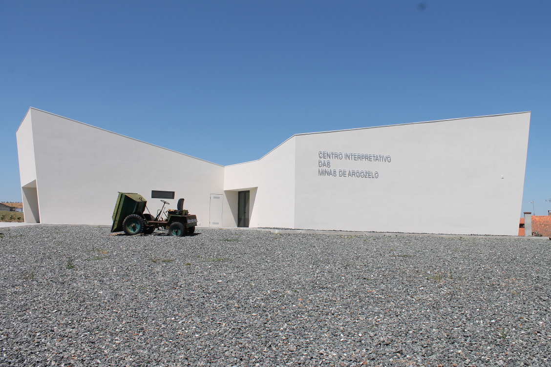
The "Centro Interpretativo das Minas de Argozelo" is located in "Cortinha do Calvário" in Argozelo. It was inaugurated on the 22nd of March 2015. The building has an exhibition room and an auditorium. In the exhibition room we can see an ex ...
Entrada da Mina
The first access to get in to the mine was made by this door. It is located inside the village of Argozelo, next to the national highway "N218". It is visible and available upon request and accompaniment.
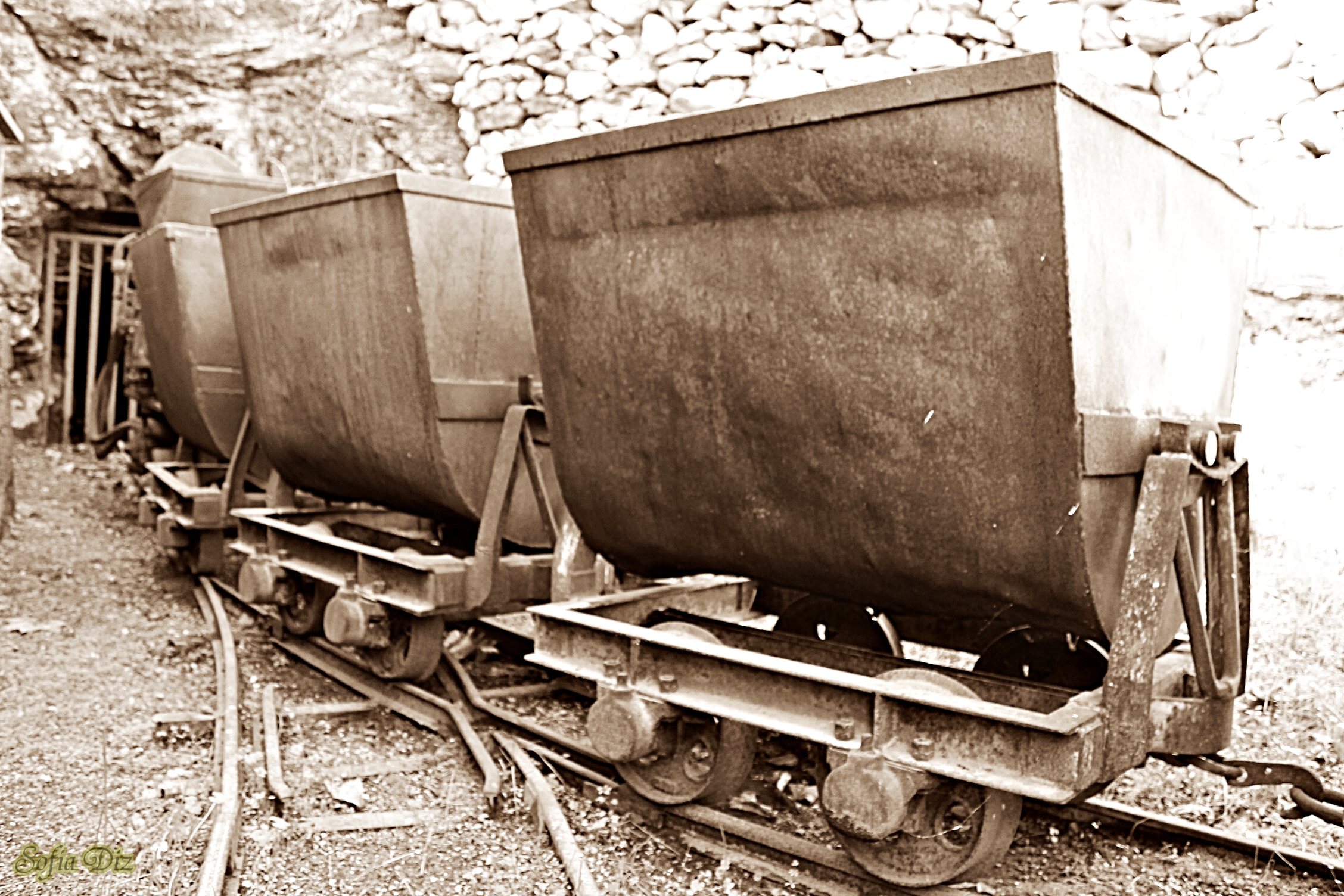
Parque mineiro
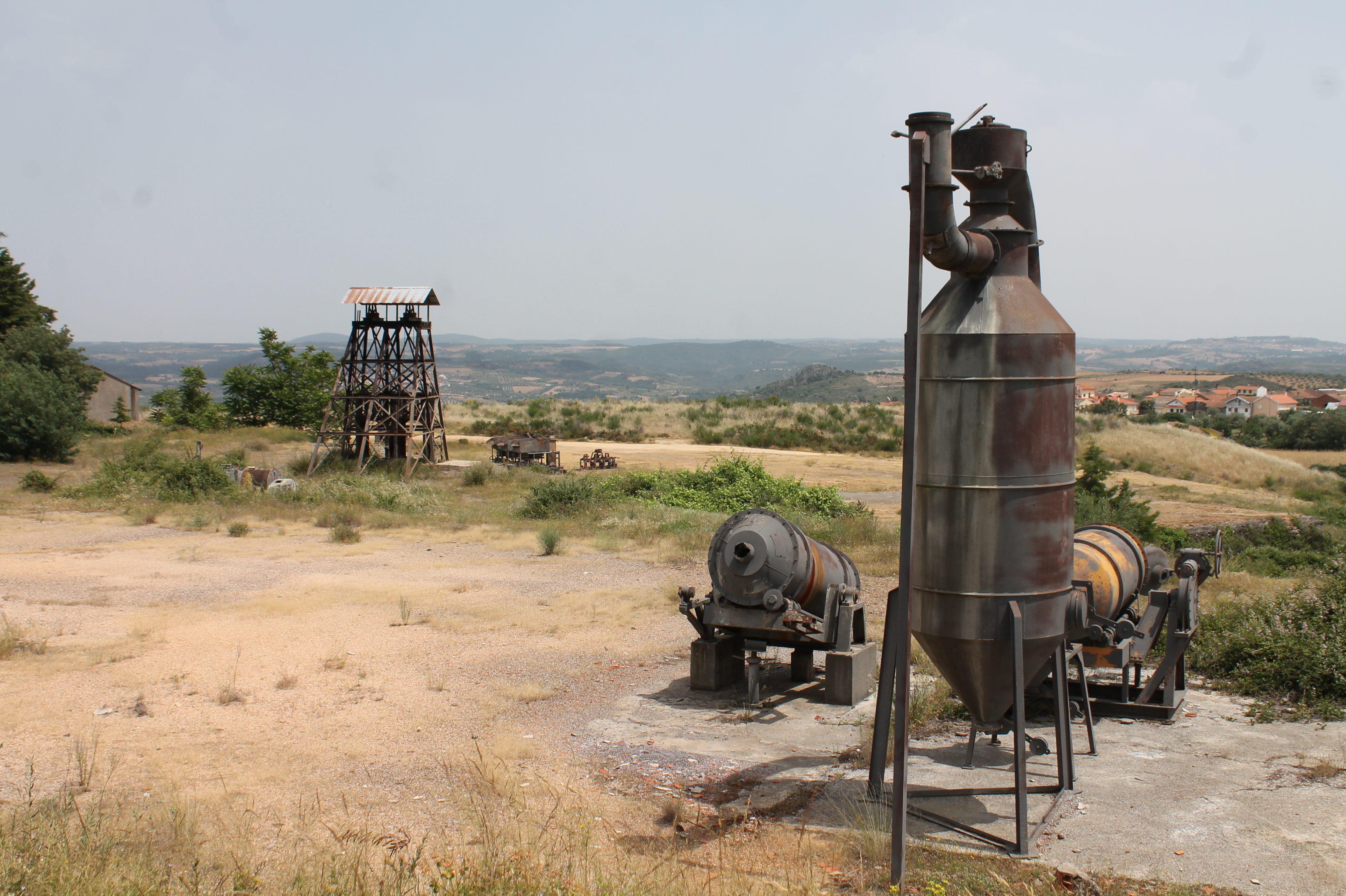
Located in the old mining area of Argozelo, here are exposed the equipment and machinery used in the during of mining activity.
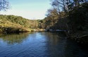
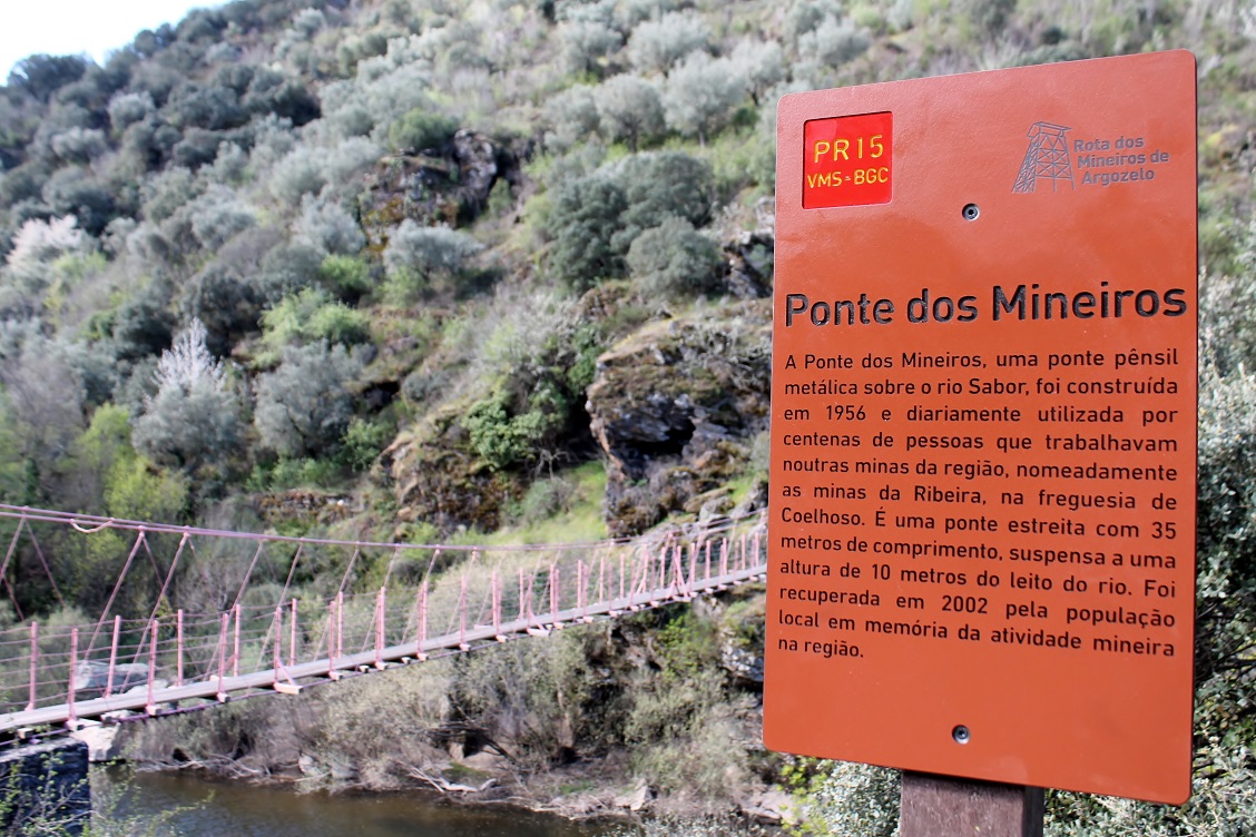
Ponte do Mineiro
The miner''s bridge it’s located over the "Sabor" river, served as a passageway for the miners who needed to cross the river to work in the mines of "Ribeira" in "Coelhoso". It’s a Cable Suspension Bridge, has about 35 meters and is suppo ...
The pedestrian route "Rota dos Mineiros de Argozelo"
The pedestrian route "Rota dos Mineiros de Argozelo" begins at the "Centro Interpretativo das Minas de Argozelo" passing through the "Parque das Minas", "Ponte do Mineiro" and "Entrada das Minas", the route have also a variant to the "Sant ...