Home /
Arouca Geopark /
Pena Amarela Mine (Geosite), Moldes
Pena Amarela Mine (Geosite), Moldes
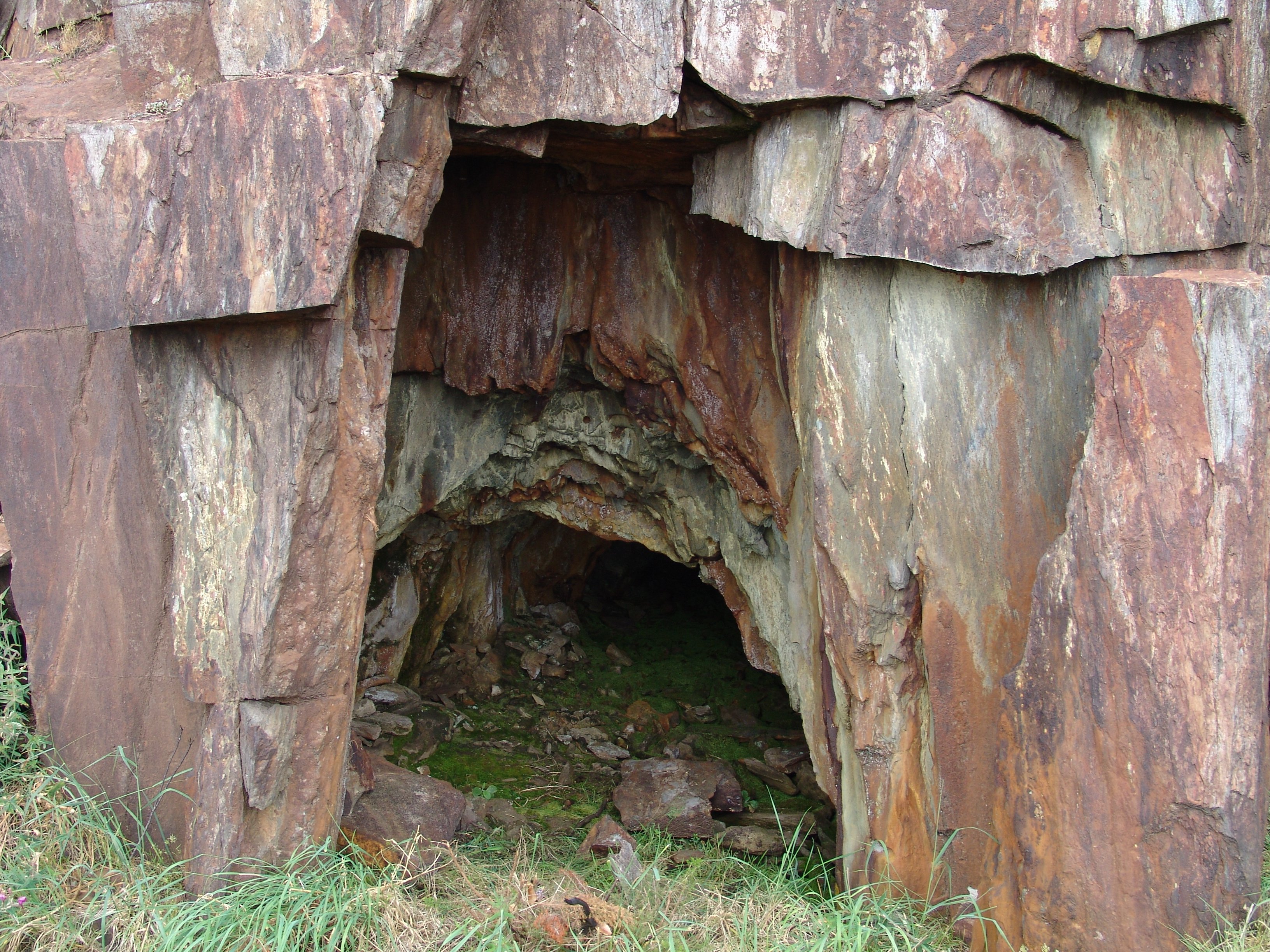
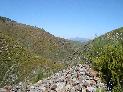
The wolframium deposits integrate with a set of subvolcanic deposits of tungsten and tin which are distributed from Galiza to Castela (Spain) crossing the northern and central regions of Portugal and defining the so called "Tin-Wolframium Iberian Province." These mineralised veins are particularly abundant in the Arouca region, especially in the area of Pena Amarela. In an involving, breathtaking landscape marked by valleys and waterfalls, you find dozens of openings to mines which evidence old clandestine mining exploitation. These can be observed from a panoramic lookout point, or by travelling down the trail near these (PR8 "Trail of Black Gold"). These were explored by the "pilhas", mainly the people from Arouca, during the so-called "Wolframic Fever." During the height of World War II, men and women with hammers and picks sought to open the hard rock, in the hopes of finding the "black gold" which would allow them to make a small fortune. Later, in 1953, these mines were granted under concession, and permits were issued for "Pena Amarela No. 1" and "Pena Amarela No. 2". As with all of the other Wolframic mines in Arouca, the failure of the product flow led to the abandonment of the mines in 1988.


CHARACTERISTICS
LOCATION
Address: Moldes
City: Moldes
Postal Code: 4540 - 000
Telephone: 256940254
Email: geral@aroucageopark.pt
Website: http://www.aroucageopark.pt
City: Moldes
Postal Code: 4540 - 000
Telephone: 256940254
Email: geral@aroucageopark.pt
Website: http://www.aroucageopark.pt
FUNCTIONING
Public venue, with no timetable or entrance fee.
ORGANISATION OF THE VISIT
The visit to this Point does not require prior booking and can be done individually.
Specific Conditions:
Visitas turísticas: marcação através de www.aroucageopark.pt e/ou geral@aroucageopark.pt. Pode também usufruir dos serviços das empresas de animação turística. Contactos disponíveis em www.aroucageopark.pt
Method:
On foot
Difficulty Level:
High
Group Visits:
Yes
Minimum Number of Person per group:
8
Maximum Number of Person per group:
30
Observations:
-
Guided Tours:
Yes
Observations:
Reservations 8 days in advance
EXISTING EQUIPMENT
Mining facilities in a gallery
EDUCATIONAL SERVICE
Activity Description:
Desde o ano letivo 2008/2009 que a AGA - Associação Geoparque Arouca desenvolve Programas Educativos em toda a área do concelho de Arouca, abrangendo diversas áreas do saber: Geologia, Biologia, Geografia, História, Turismo, entre outros. Consulte a oferta em www.aroucageopark.pt
Target Audience:
Público Escolar e Universitário
Activity Cost:
0€
Weekly Schedule:
monday, tuesday, wednesday, thursday, friday
From 09:30:00 to 12:30:00.
From 14:00:00 to 17:30:00.
Weekend and Holidays Schedule:
saturday, sunday, holidays
From 09:30:00 to 12:30:00.
From 14:00:00 to 17:30:00.
Exceptions:
-
Observations:
http://www.aroucageopark.pt/
EXTERNAL SUPPORT
Security Forces
http://www.min-saude.pt/Portal/servicos/prestadoresV2/?providerid=344
Where to Stay
http://aroucageopark.pt/pt/explorar/onde-dormir/
Cultural Facilities
http://aroucageopark.pt/pt/planear/contactos-uteis/loja-interativa-de-turismo/
Security Forces
http://www.min-saude.pt/Portal/servicos/prestadoresV2/?providerid=344
Where to Eat
http://aroucageopark.pt/pt/explorar/onde-comer/
http://www.min-saude.pt/Portal/servicos/prestadoresV2/?providerid=344
Where to Stay
http://aroucageopark.pt/pt/explorar/onde-dormir/
Cultural Facilities
http://aroucageopark.pt/pt/planear/contactos-uteis/loja-interativa-de-turismo/
Security Forces
http://www.min-saude.pt/Portal/servicos/prestadoresV2/?providerid=344
Where to Eat
http://aroucageopark.pt/pt/explorar/onde-comer/
TRANSPORT
Type of Transport:
Táxi
Agency Name:
Praça de táxis de Arouca
Telephone Number:
256944424
Parking for private vehicles:
Yes
Táxi
Agency Name:
Praça de táxis de Arouca
Telephone Number:
256944424
Parking for private vehicles:
Yes
SITES OF TOURISTIC INTEREST
Radar Meteorológico de Arouca
Nas proximidades das Pedras Parideiras podemos conhecer o Radar Meteorológico de Arouca. O seu piso panorâmico (Piso 10) é um magnífico ponto de observação da morfologia e paisagem da Serra da Freita, mas também da zona litoral entre a Serra da Boa Viagem e a região da Póvoa do Varzim e as Serras de Montemuro, Arada, Estrela e Caramulo, entre outros. Em complementaridade nesta infraestrutura propriedade do IPMA é possível conhecer o seu funcionamento técnico.
gps: 40.844923 -8.279637
distance: 0km
Pedras Boroas do Junqueiro
No relevo residual granítico do planalto da Serra da Freita destacam-se dois blocos arrendondados que exibem uma fissuração poligonal bem expressiva, assemelhando-se à côdea da broa.
gps: 40.846898 -8.271856
distance: 0km
Parede de Escalada de Cabaços
Envolta na idílica paisagem da Serra da Freita é possível encontrar a parede de escalada de Cabaços, nas proximidades da rústica aldeia com o mesmo nome. Instalada em parede granítica, os praticantes encontram neste local diversas vias equipadas para a prática da modalidade.
gps: 40.86039 -8.278465
distance: 0km
Loja Interativa de Turismo de Arouca
Inaugurada no dia 19 de setembro de 2013, a Loja Interativa de Turismo de Arouca localiza-se no centro da vila, no antigo cinema Globo D ´Ouro. Esta é uma das Lojas da Região de Turismo do Porto e Norte de Portugal e uma das portas de entrada do Arouca Geopark, sendo um espaço informativo, educativo e de realização de diversas atividades.
gps: 40.92926 -8.24816
distance: 0km
Casa das Pedras Parideiras - Centro de Interpretação
Inaugurada em 2012, a Casa das Pedras Parideiras - Centro de Interpretação é um equipamento que contribui para a conservação, compreensão e valorização das Pedras Parideiras, apoiando a visitação turística e educativa no local. Do ponto de vista geológico encontramos aqui um pequeno corpo granítico, o Granito Nodular da Castanheira, que encerra nódulos que se destacam da matriz granítica e que, desde sempre, suscitaram a curiosidade dos habitantes da região e público geral.
gps: 40.8508 -8.28257
distance: 15km
Casa da Ribeira (Sede da AGA)
A "Casa da Ribeira", situada em pleno centro histórico da vila de Arouca, é uma das poucas que resta do núcleo habitacional do séc. XVII. Sobre uma das portas pode encontrar-se a inscrição em latim "NON SINE INVIDIA ANNO 1686", que poderá traduzir-se em "Não sem inveja, ano de 1686). Nesta está instalada a sede da AGA - Associação Geoparque Arouca.
gps: 40.92912 -8.2458
distance: 0km
Campo de Dobras da Castanheira
Nas imediações da Casa das Pedras Parideiras encontramos o geossítio de relevância nacional «Campo de Dobras da Castanheira». Aqui são facilmente identificadas rochas xistentas e filões de quartzo fortemente dobrados.
gps: 40.504915 -8.161908
distance: 0km
Área de Recreio e Lazer de Albergaria da Serra
A Praia Fluvial de Albergaria da Serra, banhada pelo rio Caima, convida a momentos de descontração e contacto com a natureza.
gps: 40.86515 -8.278649
distance: 0km
Aldeia Tradicional da Castanheira
Envolta na idílica paisagem da Serra da Freita, na aldeia da Castanheira, é ainda possível encontrar a rusticidade, as tradições e história das gentes de Arouca, muito ligada à agricultura. Na sua envolvente encontramos as afamadas Pedras Parideiras, local de interesse geológico, assim denominadas pelos habitantes locais.
gps: 40.85089 -8.28257
distance: 0km
S. Pedro Velho
O marco geodésico de S. Pedro Velho impõe-se no planalto da Serra da Freita, marcando uma altitude de 1077m. Deste local de interesse geomorfológico, localizado sob um domo rochoso granítico, é possível observar a 360 graus a região norte e centro de Portugal Continental, e em grande destaque a superfície aplanada da Serra da Freita.
gps: 40.52306 -8.16506
distance: 0km
ASSOCIATED ROUTES
Wolfram Route
The history of the twentieth century is deeply marked by the arms race and the two World Wars that ravaged the European continent. During this period, the race for wolfram assumes high importance and remains large-scale until the late 1950s. Portugal emerges as the largest European producer of this mineral, benefiting from the richness of its geological resources, multiplying a little throughout the country the mining explorations that profoundly mark the evolution of the local landscape and economy. With the reduction in demand for this mineral from the middle of the century and the emergence of new producing markets, interest in wolfram in Portugal has declined, leading to the abandonment of explorations. The structures of this golden period of mining in Portugal remain in the landscape, still marking the regions that surround them.
The history of the twentieth century is deeply marked by the arms race and the two World Wars that ravaged the European continent. During this period, the race for wolfram assumes high importance and remains large-scale until the late 1950s. Portugal emerges as the largest European producer of this mineral, benefiting from the richness of its geological resources, multiplying a little throughout the country the mining explorations that profoundly mark the evolution of the local landscape and economy. With the reduction in demand for this mineral from the middle of the century and the emergence of new producing markets, interest in wolfram in Portugal has declined, leading to the abandonment of explorations. The structures of this golden period of mining in Portugal remain in the landscape, still marking the regions that surround them.
SUGGESTIONS OF THE ROUTE- OTHER NEARBY PLACES TO VISIT
Braçal and Malhada Mines
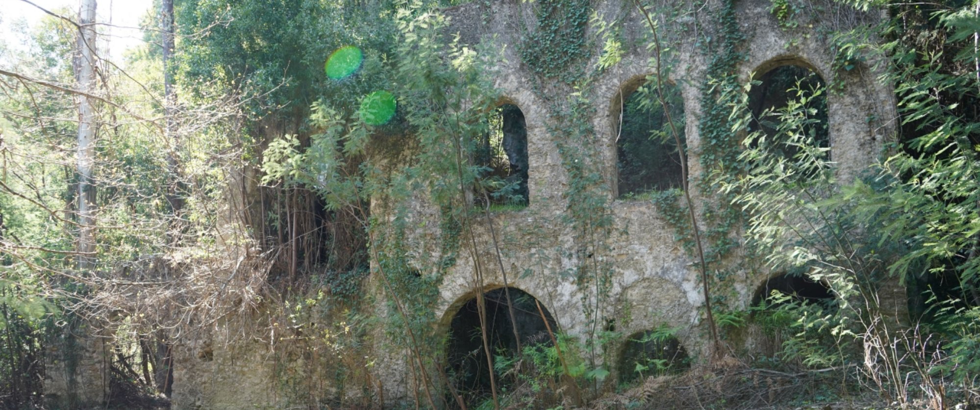
The Braçal mining complex includes the Braçal, Malhada and Coval da Mó mines and extends along the Mau River, on the eastern slope of the Serra do Braçal. This complex is the oldest Portuguese mining concession, registered under number 1, a ...
Municipal Museum
It tells the story of a territory, disclosing its heritage and elements of cultural and ethnographic interest. It is also a place where one investigates, protects and learns about Sever do Vouga's heritage. It approaches Archeology in Terra ...
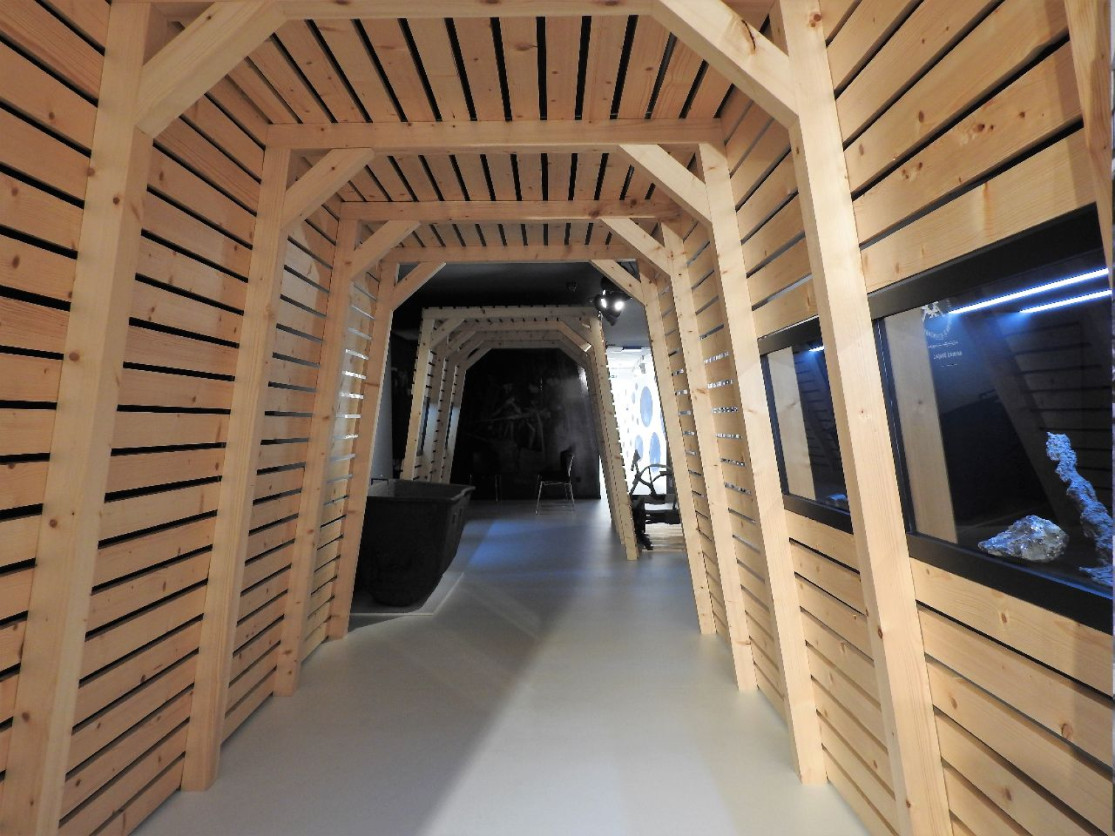
Stone Museum of Marco de Canaveses
The Stone Museum of Marco de Canaveses is more than what you see. The permanent exhibition is the first step of a project to extend the Museum to other places. In the future it will be a polynuclear museum. Larger, dynamic and innovative. ...