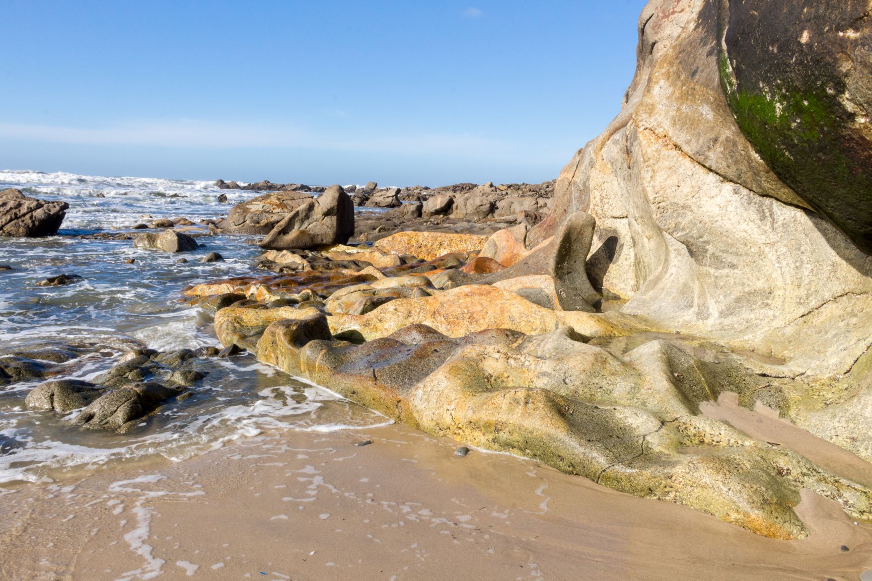
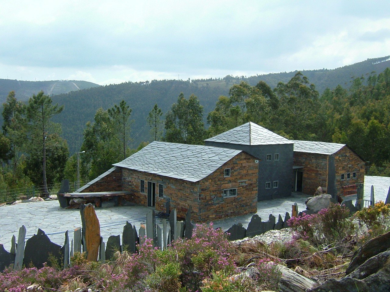
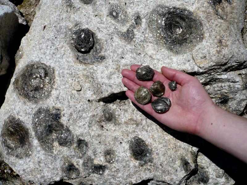
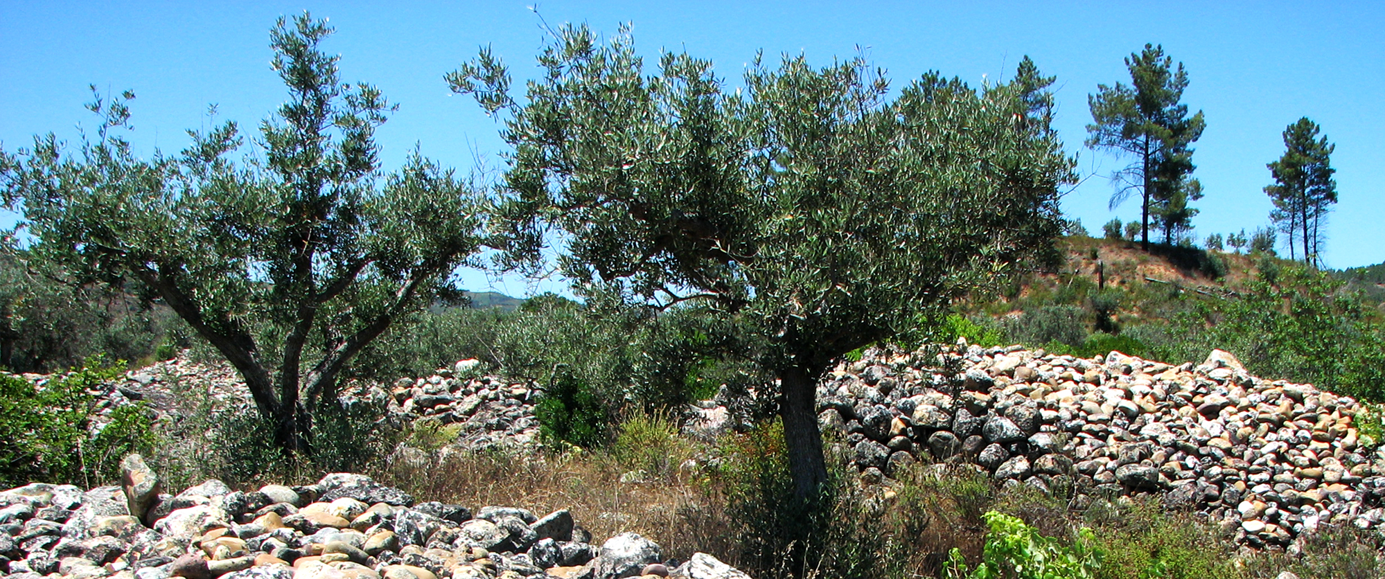
The Alcantilado de Montedor Local Natural Monument has approximately 55ha, bounded at north by the Paçô’s Fort and at south by the Camboa do Marinheiro’s Beach. The geological values identified in the area allow us to understand, in high d ...

Route - Geoparks in Portugal
UNESCO World Geoparks are territories with locations and landscapes of international geological importance, which combine the protection and promotion of its heritage with sustainable development. They are unique places where the oldest memories are millions of years old and include key locations that testify to the evolution of our planet. These territories are classified by UNESCO under the International Geosciences and Geoparks Program.
Spread across all continents, geoparks are much more than areas of heritage relevance. They are dynamic territories of which local communities are part, where nature, history and culture are intertwined.
There are currently 5 UNESCO World Geoparks in Portugal: Naturtejo (2006), Arouca (2009), Azores (2012), Terras de Cavaleiros (2014) and Estrela (2020).
The Geopark on the coast of Viana do Castelo is preparing the future application, but its level of implementation in the territory, namely the educational offer it already develops, led to its inclusion in the GUIDE OF THE PORTUGUESE GEOLOGICAL AND MINES SITES, naturally without the status that UNESCO gives to the remaining territories.
On the other hand, new applications are being developed, with several projects in the Oeste, Algarve and Figueira da Foz, which in due time may have their presence on this platform.
To visit Portuguese geoparks is to embark on a journey that began 600 million years ago, when Portugal occupied a very different place on the globe, going through incredible episodes of formation and destruction of mountains and seas, of the appearance and extinction of species, of the occurrence of deep climate change, major volcanic eruptions ... until today in the relationship between man and the planet
On this GUIDE the visitor will find a proposed itinerary to visit the most significant points in each national geopark, including, of course, the one located in the Autonomous Region of the Azores.
Take a "good trip" on the GUIDE OF THE PORTUGUESE GEOLOGICAL AND MINES SITES and discover the interesting places we introduce you throughout the country.
Points of Interest to visit at this Location
Alcantilado de Montedor Local Natural Monument
Magmatic Drops in Canto Marinho Natural Monument
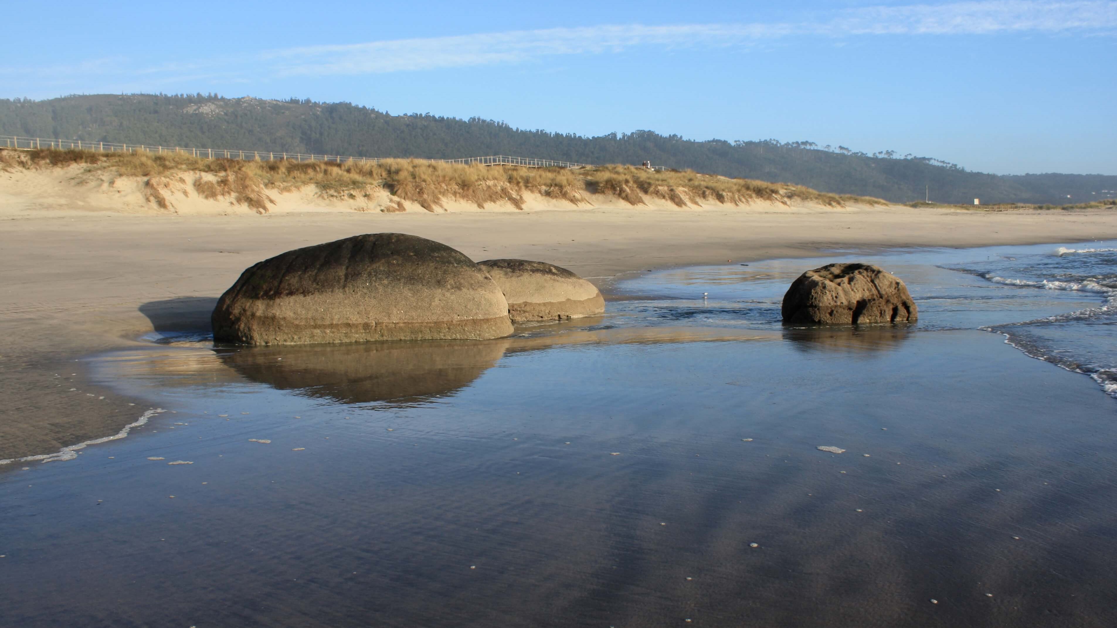
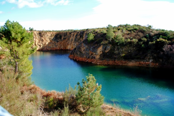
The Magmatic Drops in Canto Marinho Natural Monument is an area of about 24 ha, in the intertidal area of the Carreço coast, south of the Ancient beaches of Alcantilado de Montedor Natural Monument. This geosite presents some exclusive asp ...
Pedras Ruivas Local Natural Monument
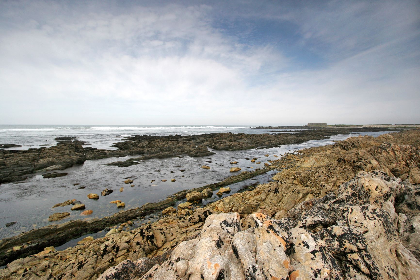
This geosite, classified as Pedras Ruívas Local Natural Monument, corresponds to an area of approximately 58 ha, delimited between the northern proximal coastal sector of the Rego de Fontes Fort and the southern end of Praia Norte, with an ...
Paiva Walkways
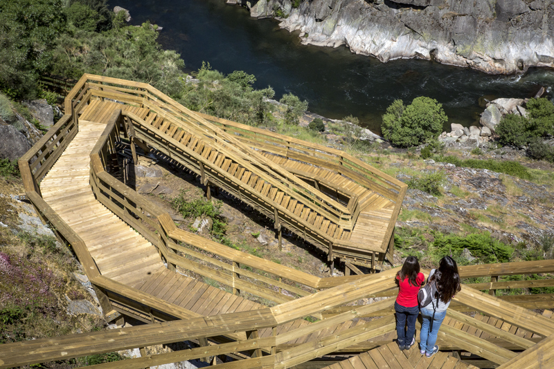
The Paiva Walkways (Passadiços do Paiva) are located on the left bank of the Paiva River. Along 8700 m the path provides an "untouched" tour, surrounded by landscapes of unparalleled beauty, which lead us to discover a set of five Arouca Ge ...
Museum of the Giant Trilobites
The fossils collection of the Trilobites Museum, also known as the Geological Interpretation of Canelas Center (CIGC), is a geosite with international relevance. Open to the public since 1 of July, 2006, in the parish of Canelas, is located ...
Complexo mineiro da Poça da Cadela, Regoufe (Geosite)
Since the beginning of the 20th century the "Mine Manifests" have declared numerous areas of metalliferrous interest in the parish of Regoufe. On January 9, 1915 the permit was issued for the exploitation of the "Regoufe Mine," or Poça da C ...
Minas de estanho e volfrâmio de Rio de Frades (Geossítio)
Currently abandoned, the Rio de Frades Tin and Tungsten Mines were exploited by the Companhia Mineira do Norte de Portugal (Northern Portugal Mining Company), of German ownership, which was at its height during the Second World War. Accordi ...
Frecha da Mizarela Overview (Geosite)
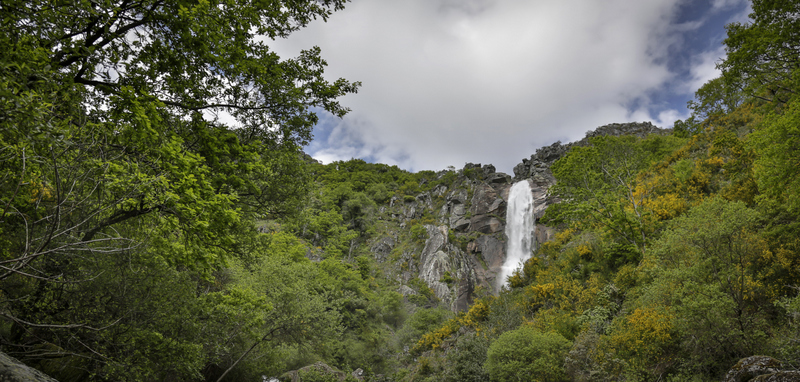
Panoramic view, of national importance, where the highest waterfall of Portugal can be seen, located at the contact between the Serra da Freita granite and the ante-Ordovician metasediments (schists and greywackes). As granite is more resis ...
Birthing Stones Geosite (Pedras Parideiras)
In November 3rd, 2012 was inaugurated the House of Parideiras Stones - Interpretation Centre. This is a house that aims to contribute to the conservation, understanding and appreciation of this important geological heritage and to promote i ...
Costa da Castanheira Viewpoint (Geosite) - Radar Meteorológico de Arouca
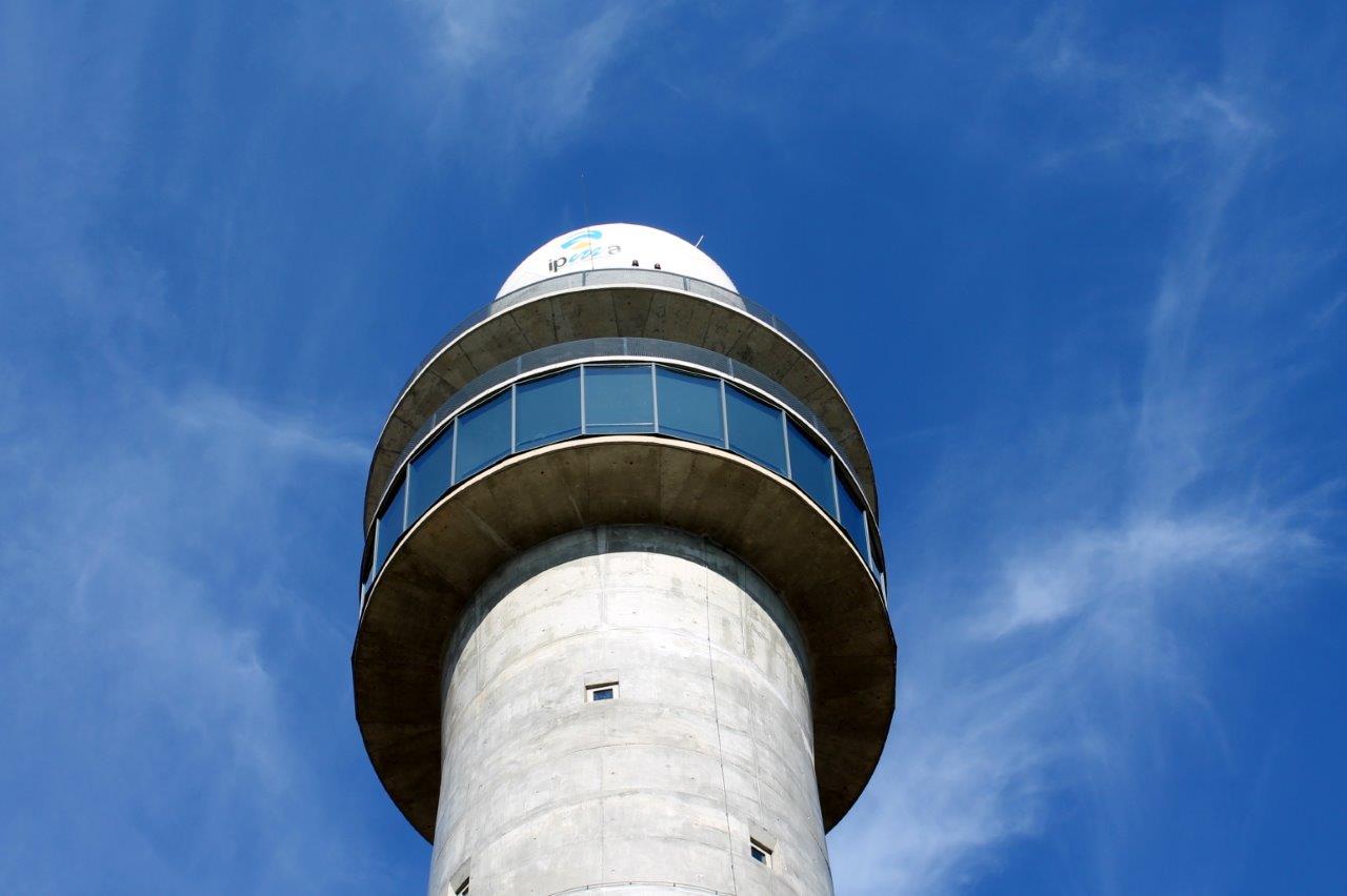
In Serra da Freita, near the village of Castanheira, you can rise to the Panoramic Floor of the Arouca Meteorological Radar (10th floor) and understand the operation of this technical infrastructure, at the service of the Portuguese Institu ...
Geosite Murços Mines
The mining complex of Murçós consists of several open-air exploration fronts, galleries, some of them submerged and by supporting buildings such as the mining plant and offices. The mining activity was associated with the exploitation of tu ...
Geosite Salselas Limestone
In the village of Salselas there are traces of an old limestone exploration. Limestones are very common rocks on the coast and south of Portugal but are rare in the northern interior. This small outcrop constitutes an example of the use of ...
Geosite Poço dos Paus Dikes

In this geosite you can see rocks that waere formed at the bottom of the ancient Rheic ocean. This ocean disappeared due to the collision of the continents that limited it. This is the best proof of the presence of an ancient oceanic crust, ...
Geosite Cromite at Morais

In this geosite we can observe a rock from the Earth`s mantle. It is called by Dunite and is a rock of the peridotite group consisting essentially of dark minerals. This minerals are rich in magnesium and iron, such as olivines, pyroxenes a ...
Geosite Gneiss of Lagoa
The Gnaisse of Lagoa is a rock with about 500 million. This rock resulted from the metamorphism of granites and it is formed by large, clear and elongated feldspar minerals that resulted from the high pressure and movement to which the rock ...
Geosite Conrad and Moho discontinuities in Lagoa

In this geosite, in addition of the uncommon rocks, we can also see the Conrad and Moho seismic discontinuities. "Seismic discontinuities" are limits that separate different types of materials inside the planet Earth and are known for the c ...
Geosite Foz do Azibo Thrust Fault
In this geosite there is an important discontinuity between the ocellated gneisses (clearer rock) of the Armorica continent with about 500 million years and the amphibolites (darker rock) ancient basalts of the bottom of the ocean Galiza-Tr ...
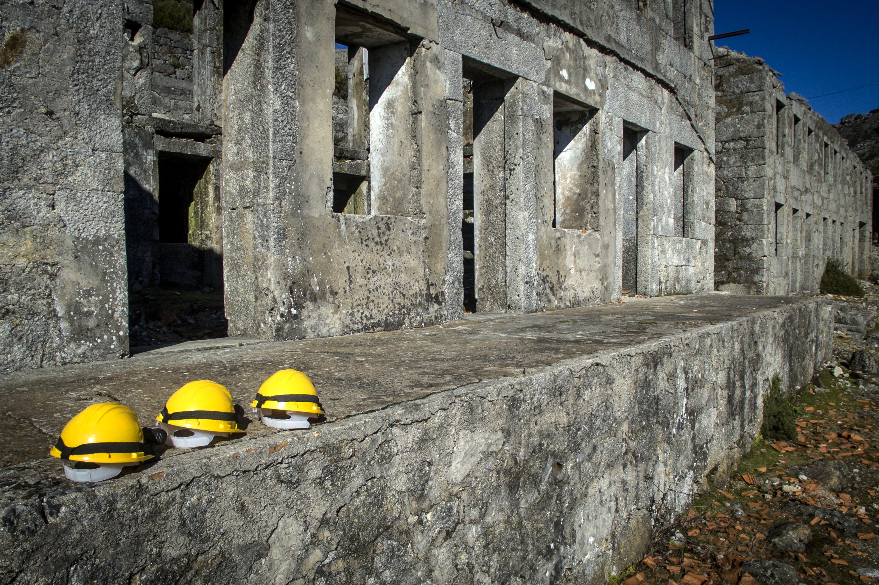
Roman Mining Complexo of Presa
The Roman Mining Complex is a remarkable testimony of the roman mining activity of the gold exploitation in the northeastern roman province "Hispania Vlterior Lusitania". The spectacular dimensions achieved by these auriferous open pit work ...
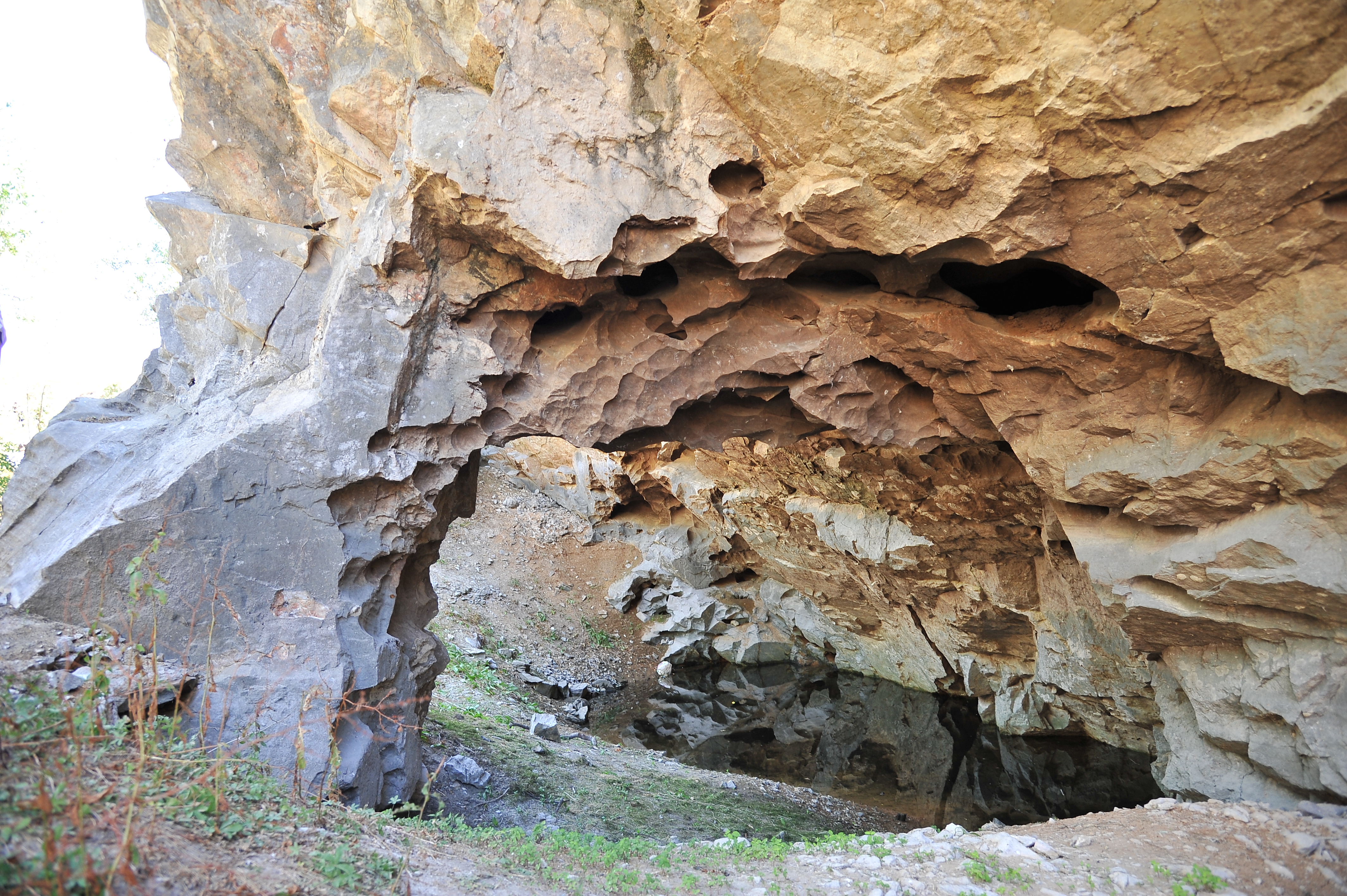
Ichnological Park of Penha Garcia
The Ichnological Park of Penha Garcia is one of the ex-libris of the Naturtejo Geopark and its geological history dates back 480 million years, when the region was covered by a shallow ocean, full of life, on the margin of the supercontinen ...
Granite Landforms of Gardunha
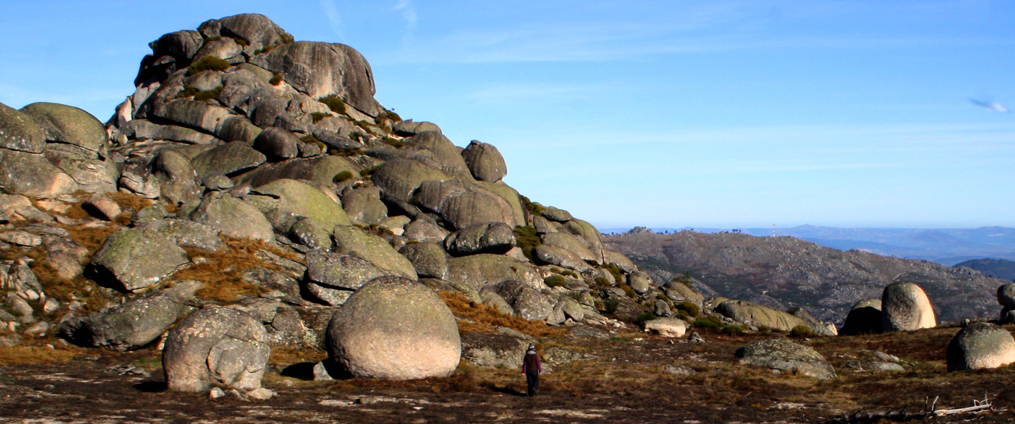
A colossal granite giant rises abruptly over the vast plain of Castelo Branco, reaching 1227 m high. Surrounded by a pine forest ring up to 800 m, its bare peaks resemble ruined castle. These accumulations of granite morphologies are freque ...
Fraga de Agua d’Alta Waterfall
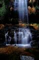
The Agua d’Alta Cliff is the largest existing waterfall in the Naturtejo Geopark and in all of the Beira Baixa, in the Agua d’Alta River, with a drop of 50 metres followed by a succession of 3 veils of turbulent water. It is possible to obs ...
Portas de Almourão Geomonument
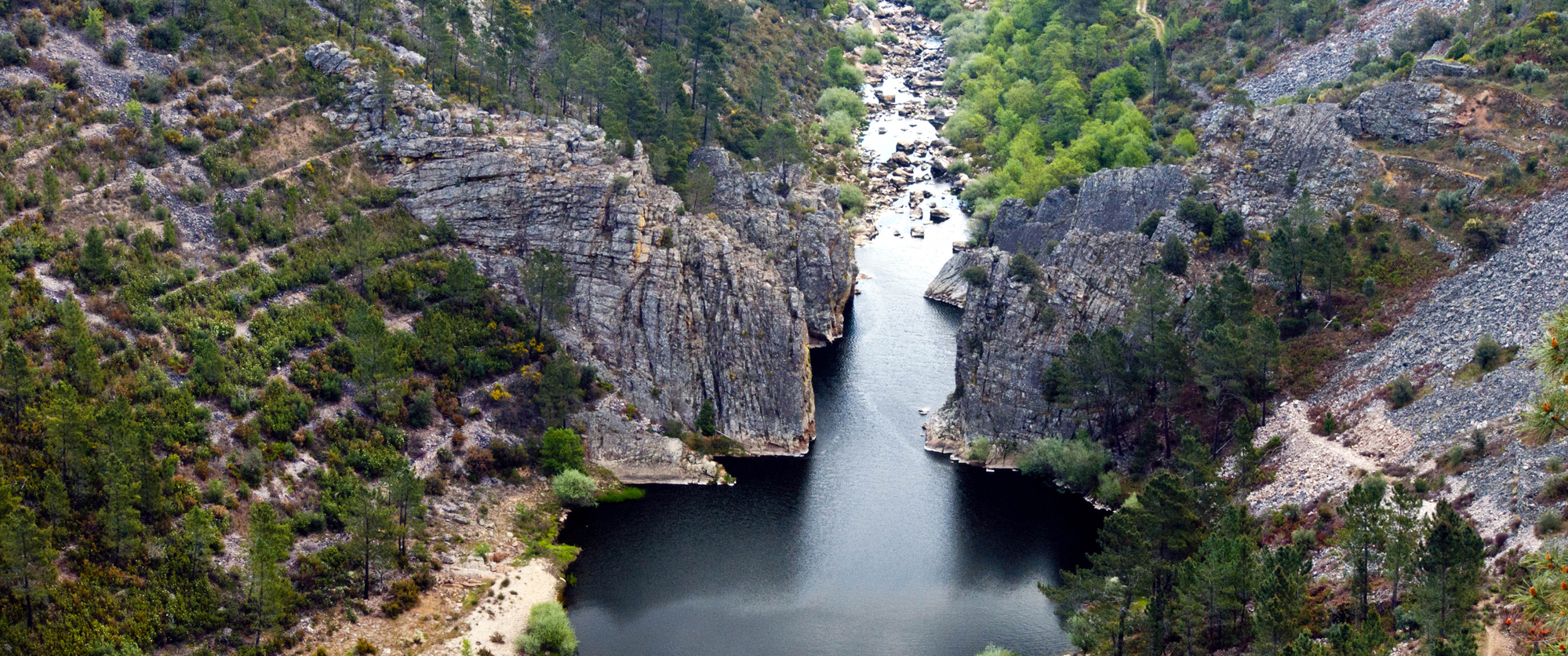
Portas de Almourão Geomonument is an enchanted place where Ocreza disembowelled the intensely deformed quarzite cliffs with its erosive force over time. From the lookout points it is possible to see the Foz do Cobrao and the Sobral Fernando ...
Portas de Ródão Natural Monument
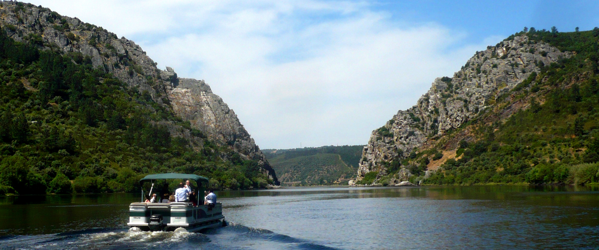
In the Portas de Ródão Natural Monument the largest river on the Iberian Peninsula, the Tejo, runs entrenched and submissive between the giant quartzite formations. The river erosion advanced at a speed of only 10 cm every 1000 years over t ...
Conhal do Arneiro Roman Gold Mine
The Conhal do Arneiro is an open pit mining where gold was extracted through the gravitational breakdown of the sedimentary deposits on terraces, comprised of conglomerates. The remains of this mining exploitation of Roman origin occupy a r ...
Fajã Grande e Fajãzinha - Geosite

"Fajã Grande" and Fajãzinha are coastal areas of lava deltas and fluvial and scree-slope deposits, contiguous to the central plateau and separated from it through a long and about 300 m high fossil sea cliff. Several streams cascades down t ...
Caldeirão - Geosite

Caldeirão is a collapse caldera emplaced on the top of the polygenetic volcano of Corvo island, the smallest of the Azores archipelago. The caldera is about 2.3x1.9 km in diameter, 305 m depth and includes a set of scoria and spatter cones ...
Vulcão dos Capelinhos e Costado da Nau - Geosite

Capelinhos is the most recent and western monogenetic volcano of the Capelo peninsula. The 13 months basaltic eruption (September 27th, 1957 to October 24th, 1958) started as submarine and evolved to a terrestrial one, originating a tuff an ...
Montanha do Pico - Geosite

Pico Mountain (Montanha) is the highest point of Portugal (with 2,351 m altitude) and the youngest and biggest polygenetic volcano of the Azores. At 2,050 m there is an older crater and at 2,250 m altitude, Piquinho driblet cone is nested i ...
Caldeira e Furna do Enxofre - Geosite

"Caldeira" is a collapse caldera emplaced on the top of the polygenetic volcano that occupies the SE sector of Graciosa island. Inside the depression there are two hydromagmatic cones, a swampy area and a volcanic cave "Furna do Enxofre". W ...
Algar do Carvão - Geosite

"Algar do Carvão" is a volcanic pit, on Terceira island, with a peculiar genesis, including both silicic formations (dated of 3,200 years B.P.) and basaltic products. This 90 m depth pit has a lake and exhibits stalactites and stalagmites o ...
Caldeira do vulcão das Furnas - Geosite

Furnas volcano is a silicic polygenetic volcano with a summit caldera complex, the older with 8x5.6 km across. The geodiversity associated includes a volcanic lake (Lagoa das Furnas), domes and tuff rings, and a diversified hydrothermal sys ...
CITEG - Estrela Geopark Torre Interpretation Centre
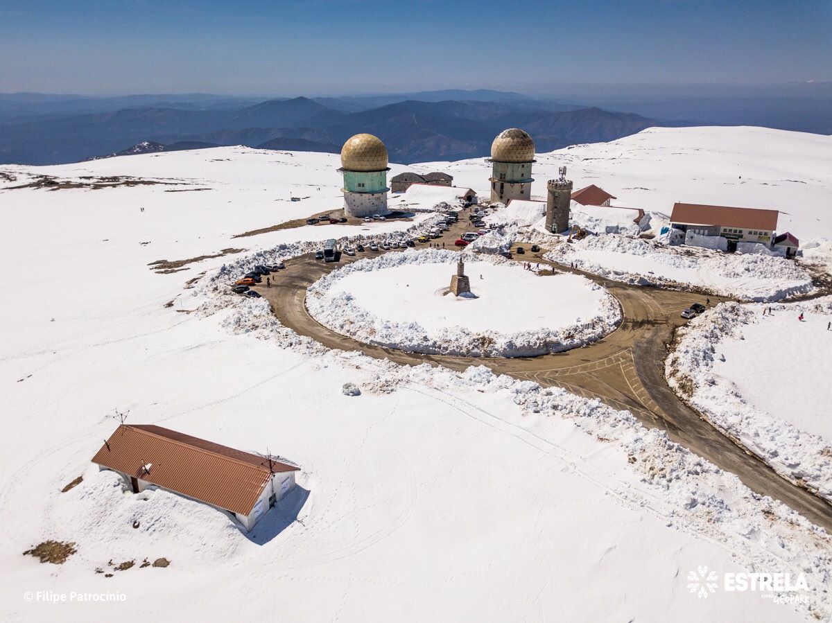
The CITEG, located in the Tower of Serra da Estrela, aims at recognizing and valorising the Natural and Cultural Heritage of this territory, as well as safeguarding its identity.
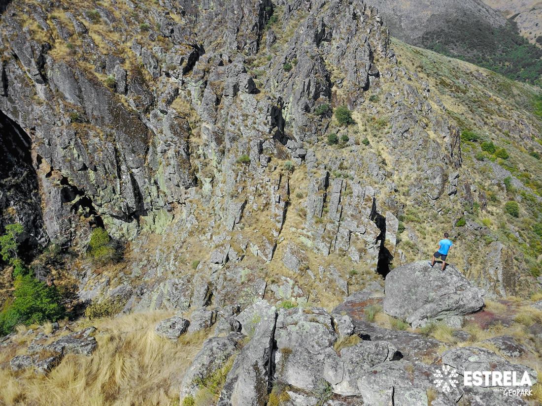
Granite collumns of Covão do Boi (Geosite)
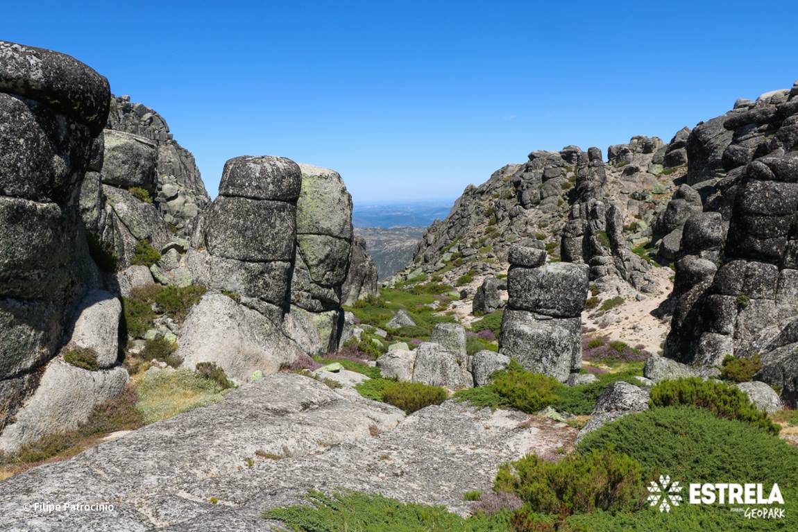
Between the glacial cirque of Covão do Ferro, the Zêzere glacial valley and the Cântaro Raso, the Covão do Boi, located at 1840 meters a.s.l., appears. In this geosite we find a set of granite columns, with diameters of 2 to 5 meters and be ...
Alforfa glacial valley (Geosite)
This glacial valley, controlled by the fault that extends from Bragança to Unhais da Serra, illustrates the main characteristics of a valley glaciation, with overdeepenings and riegels, moraine deposits illustrating different phases of glac ...
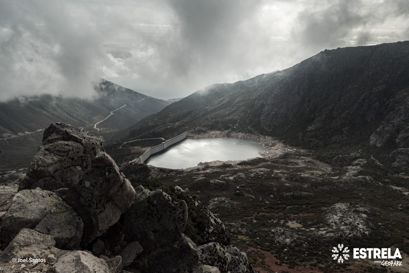
Zêzere glacial valley (Geosite)
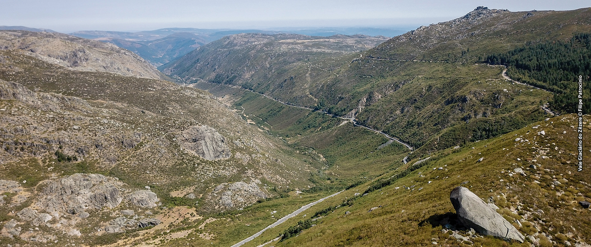
The Zêzere valley is a perfect example of glacial erosion. With a U-shaped cross-section profile along 10 km, between Covão da Ametade and the town of Manteigas, the valley presents in its upstream sector a succession of overdeepenings, rie ...
Varanda dos Carqueijais panorama (Geosite)
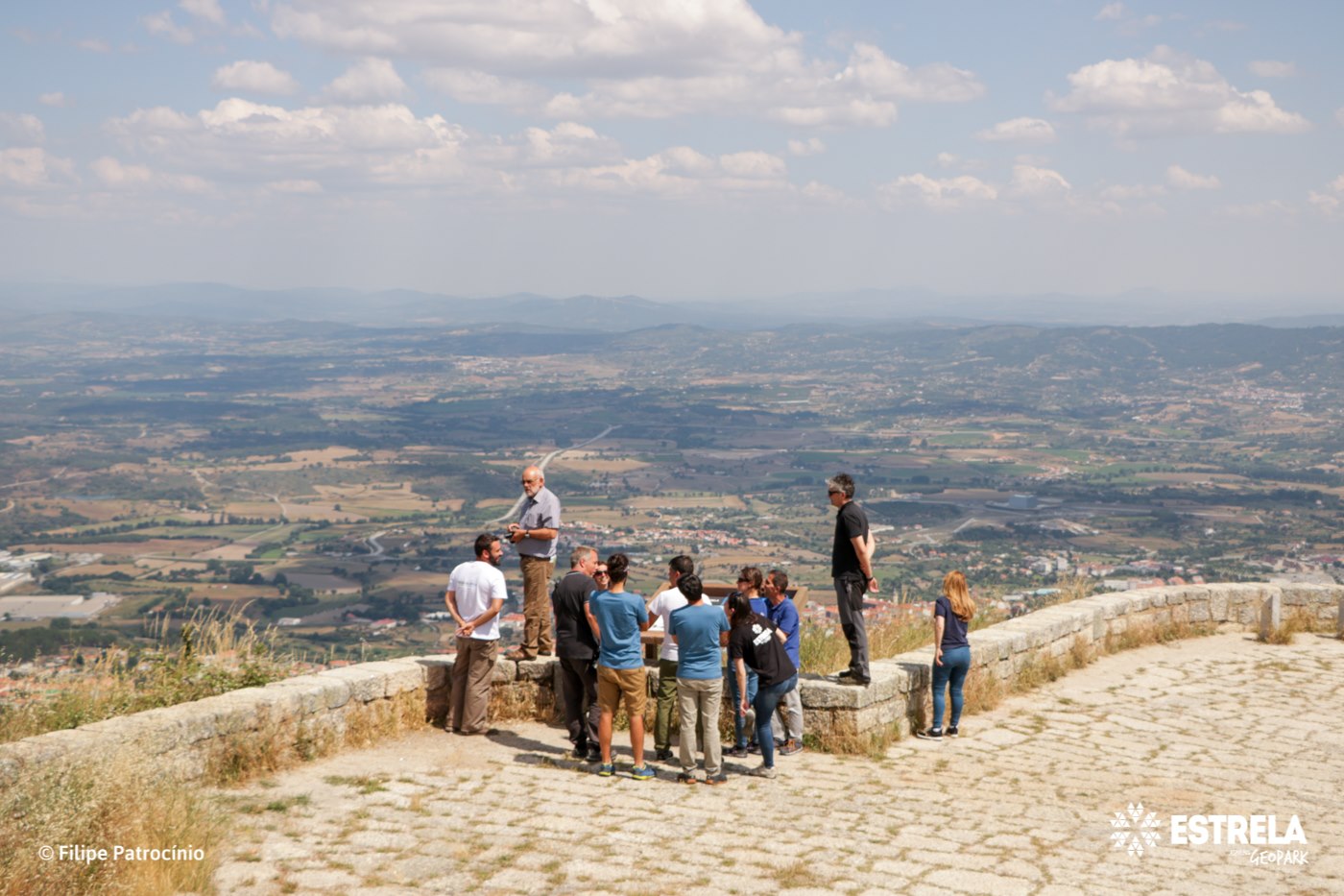
From here you can enjoy a magnificent panoramic view over Cova da Beira and further away, to the Castelo Branco Surface. These were the surfaces that, about 10 million years ago, gave origin to Serra da Estrela, which raised between tectoni ...
Mocho Real panorama (Geosite)
Built over granite rocks, 700 meters a.s.l, the Mocho Real panorama offers an excellent view of the Mondego valley, the Caldeirão river gorge and the body of water of the dam with the same name. From this point we observe the human action a ...