Recently requalified, the Tresminas Interpretive Centre is an added value to understanding the dynamics of the Tresminas Roman Mining Complex. It has two buildings, geared to the interpretation of historical and archaeological heritage and ...
Route - Roman Route of Gold in North Portugal
Roman Route of Gold in North Portugal
The Roman Route of Gold in the North of Portugal is a proposal for a mining and geological tourism route dedicated to the exploration of the mineral resources of gold in the North of Portugal, a region that in Roman times constituted one of the main areas of gold mining of the Roman Empire.
The mineral wealth of the region, which forms part of the Galaico-Transmontana zone of the Hesperian Massif, derives from its geological characteristics, potentiating the existence of metallic resources, namely gold, tin, iron, lead and silver. Although the knowledge and exploration of this wealth has been archaeologically documented since the Bronze Age and Iron Age, it is during the Roman dominion (I-IV centuries) that this exploration knows a greater increment and is done in a systematic, proto-industrial way.
In the north of Portugal (Douro Litoral, Minho and Trás-os-Montes), about fifty mining explorations of Roman times are inventoried, representative of the open and / or subterranean survey modalities. Between the opencast mines stand out the mines of Tresminas (Vila Pouca de Aguiar) and Poço das Freitas (Boticas). Among the underground explorations are mines of Fojo das Pombas in Serra de Santa Justa and Pias (Valongo) and the mines of Castromil (Paredes).
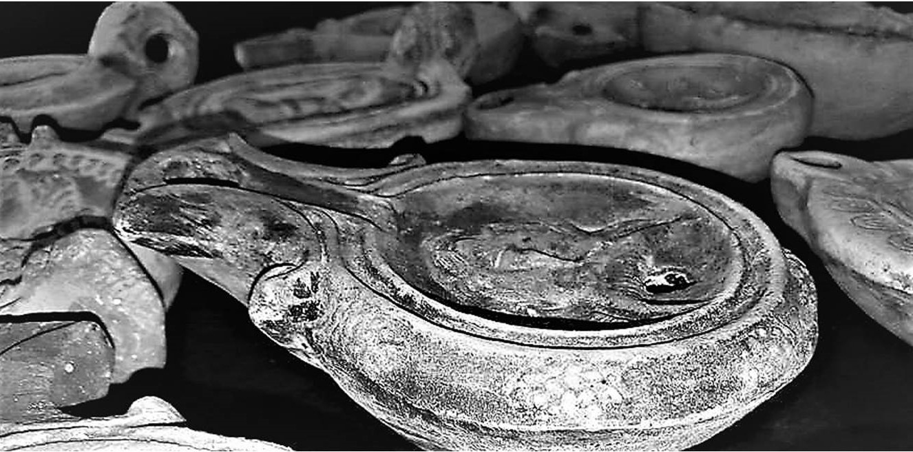
In addition to the material evidence of the ancient Roman mining explorations, such as shoring, galleries, canals, wells, heaps, and settlements correlated with mining work, the visitor will find interpretation centers / museological spaces such as the Interpretation Centre of the Vale do Terva Archaeological Park (Boticas), the Tresminas Interpretative Center (Vila Pouca de Aguiar), the Castromil and Banjas Gold Mines Interpretation Center (Paredes) and the Environmental Interpretation Centre - CIA of Valongo Palaeozoic Park (Valongo), where you will find detailed information on the geological characteristics of the region and on the archaeological evidence of Roman mining.
Author: LFontes / UAUM
Thanks:
Universidade do Minho
Município de Boticas
Points of Interest to visit at this Location
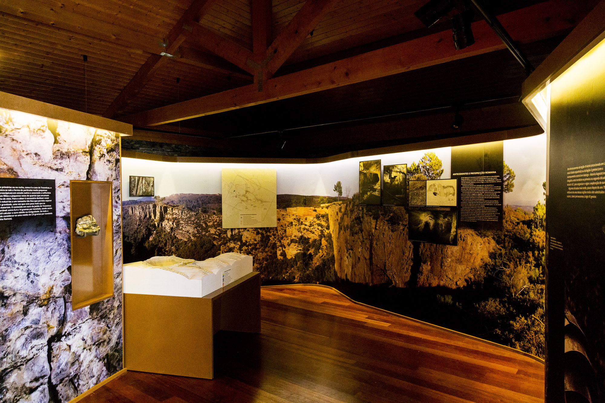
Tresminas Interpretation Centre
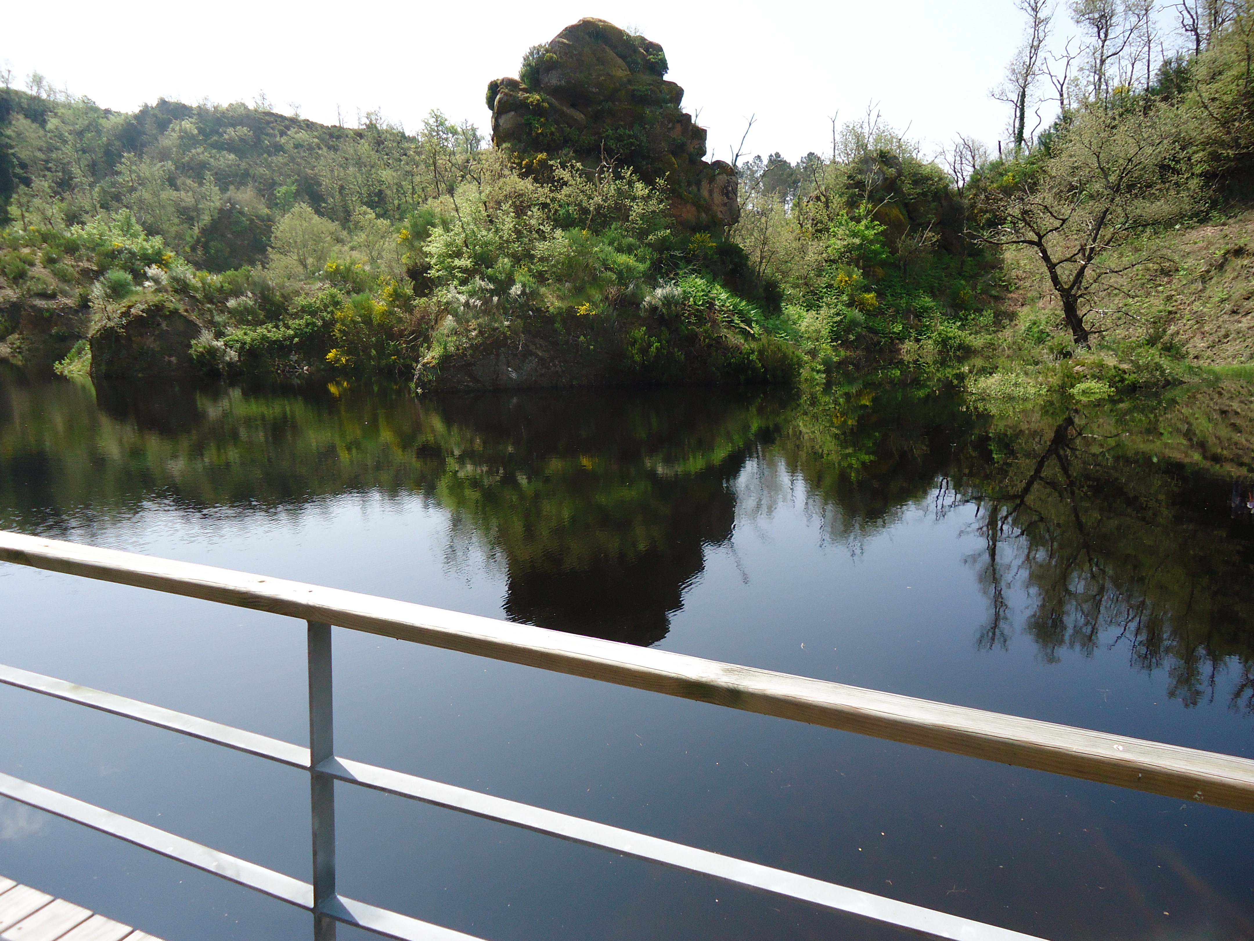
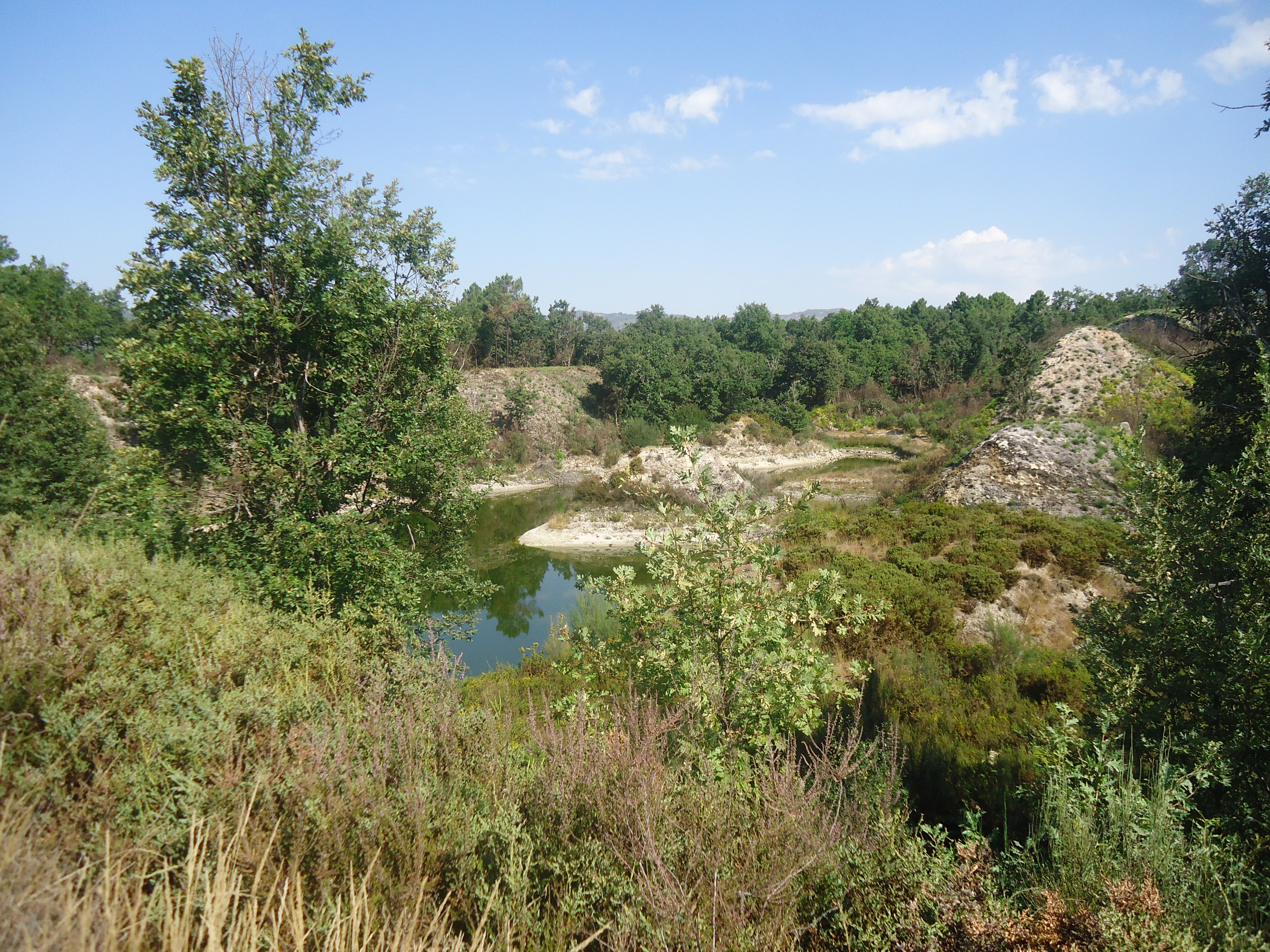
Tresminas Roman Mining Compound

Considered to be one of the largest mining exploitation sites of the Roman world, mining at Tresminas began during the reign of Augusto (27 BCE - 14CE), and lasted through the time of the Seventh Severo. The activity was conducted through t ...
Centro de Intepretação das Minas de Ouro de Castromil e Banjas
In Paredes, the Castromil and Banjas areas shows important vestiges of the auriferous exploitations of Romans times. This region belongs to the northwest Iberian Peninsula that has been considered one of the richest and most gold produced ...
Castromil Gold Mines

The municipality of Paredes in partnership with the Department of Geosciences of FCUP have worked in the preservation and promotion of the the Gold Mines of Castromil. This work received an Honorable Mention in the Geoconservation Award, 20 ...
Environmental Interpretation Centre

The Environmental Interpretation Centre - CIA, is a space for reception of visitors, for the dissemination and promotion from the Área de Paisagem Protegida Local (Local Protected Landscape Area) of the Serras de Santa Justa e Pias (Santa J ...
Red Route / Fojo das Pombas

Pedestrian trail "built in land with lithology from the Precambrian and/or Cambrian Periods and up through the Ordovician Period. In the beginning of this trail, lithology such as schist and siltites from the Ordovician Period is present. A ...
Interpretation Centre Of Archeaological Park of Terva Valley (CI PAVT)
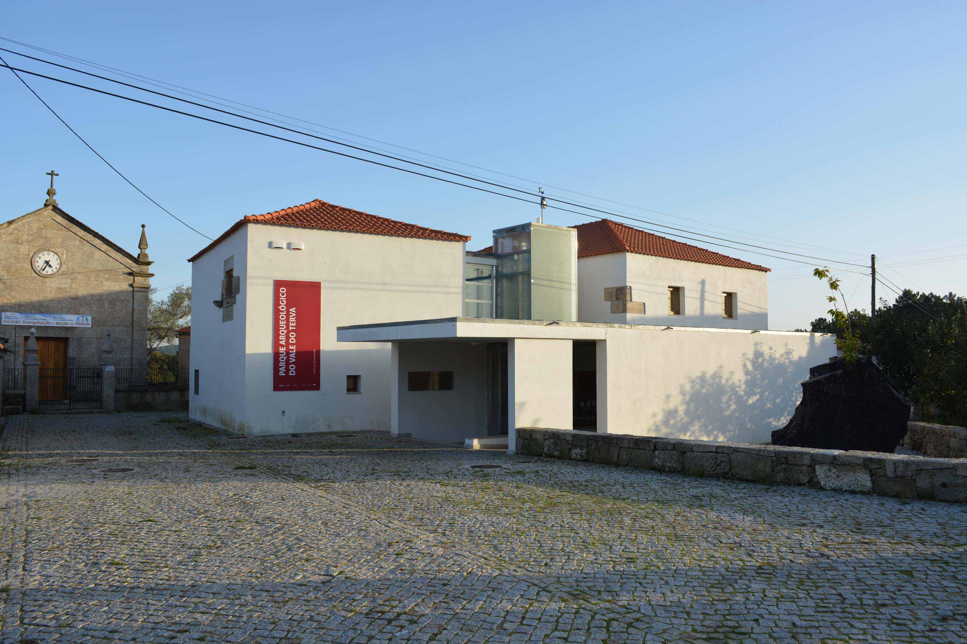
The Interpretation Centre of PAVT- Archaeological Park of Terva Valley, located in Bobadela village. Works as a place of knowledge, providing a permanent exhibition that presents the features and history of the area, given that the visitor ...
Brejo Mines
Brejo is another open pit mine regarding the Roman Era Mining Complex in the upper valley of the Terva River. This exploration, disposed close to theBrejo stream, is distributed over an area of approximately 12 hectares, just outside the vi ...
Limarinho Mines
Located East of the Calvão stream, the exploration front of the Limarinho corresponds to an open pit gold mine, operated extensively between the mid-1th century and the 4th century. Entering through the large trench, that from the stream m ...
Poço das Freitas Mines
Being the name that historically more often appears associated to the Ancient Mining Complex of the upper Valley of the Tervariver, the mining site of Poço das Freitas is located south of Limarinho, embedded between the banks of Calvão and ...